← pak-heritage.site · National Heritage Atlas
Pakistan heritage cards
6 inscribed World Heritage properties · 29 Tentative List sites. Independent civil-society documentation — not a government, UNESCO or DOAM platform.
Inscribed World Heritage properties (6)
Archaeological Ruins at Moenjodaro
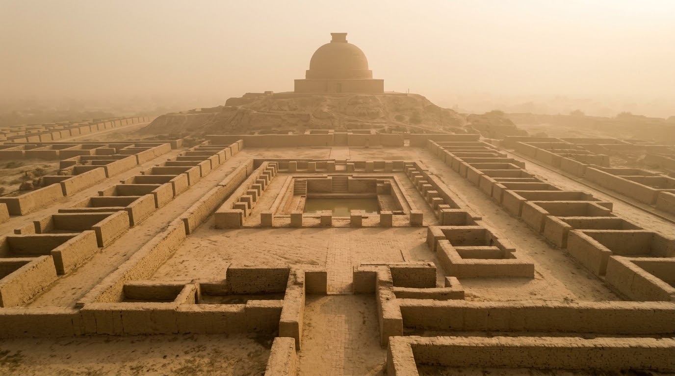
UNESCO inscribed: Protected: Antiquities Act 1975Moenjodaro represents the pinnacle of Bronze Age urbanism in the Indus Valley, dating from the mid-3rd millennium BCE. The site is split into a fortified Citadel mound and a lower town laid out along a strict orthogonal street grid network. Built entirely of standardized baked bricks conforming to a precise 1:2:4 ratio, Moenjodaro features advanced public works including subterranean covered street drains, private household baths, and the monumental communal Great Bath basin lined with bitumen to prevent water leakage.
Archaeological Ruins of Taxila
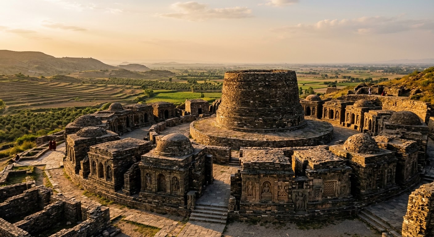
UNESCO inscribed: Protected: Antiquities Act 1975Taxila preserves a thousand-year urban sequence documenting the crossroads of South Asian, Persian, and Mediterranean civilizations. The site encompasses three distinct successive city settlements: Bhir Mound, the cardinally aligned Greek-style grid city of Sirkap, and the stone-walled Kushan metropolis of Sirsukh. Key architectural highlights include the Jandial Temple with classical Greek Ionic column capitals and the Shrine of the Double-Headed Eagle, alongside sprawling Buddhist monasteries like Dharmarajika and Bhamala.
Buddhist Ruins of Takht-i-Bahi and Sahr-i-Bahlol
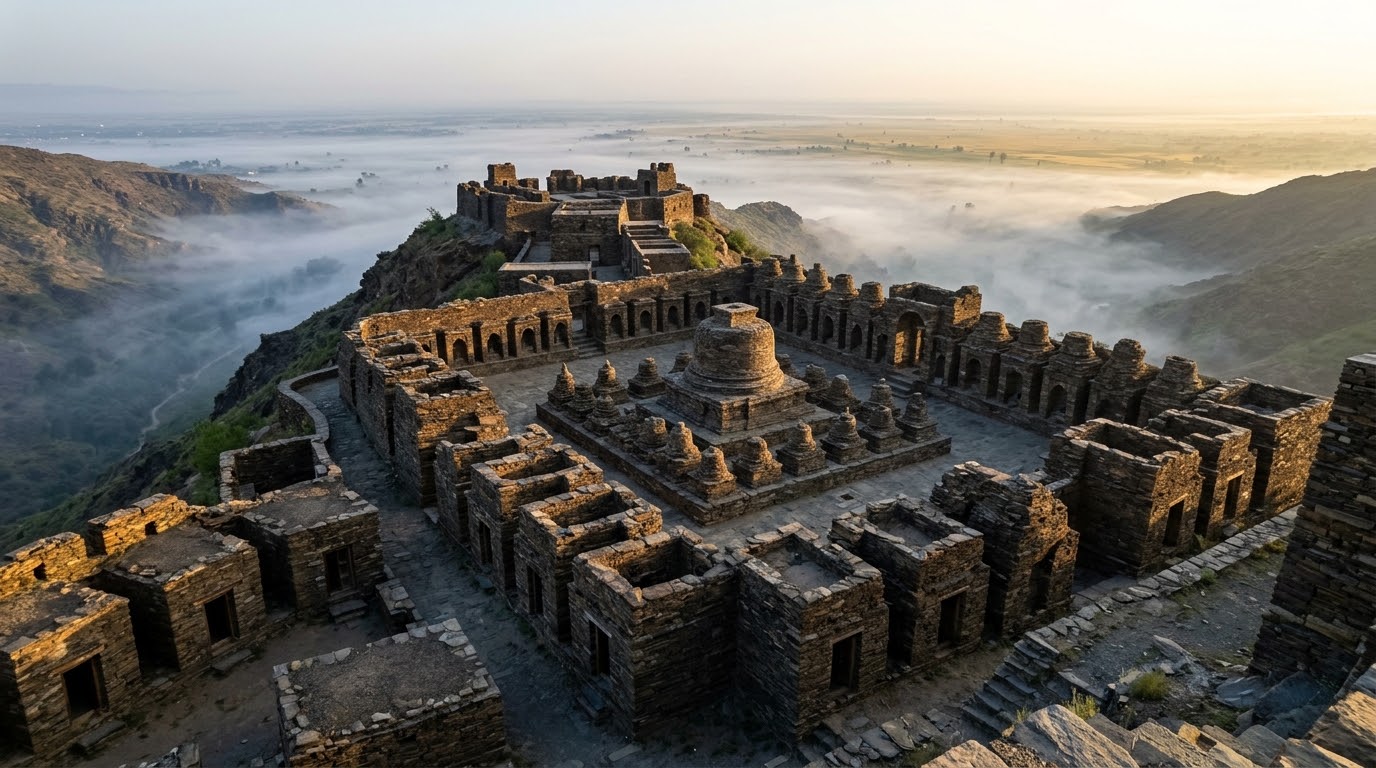
UNESCO inscribed: Protected: KP Antiquities Act 2016Perched on a mountain crest in Mardan, the monastic complex of Takht-i-Bahi is one of the most complete and well-preserved Buddhist sanctuaries in Gandhara. Built of local dark limestone masonry, the monastery is terraced across different levels to house a central court of stupas, vaulted monk cells, and cool underground meditation vaults designed for quiet reflection. The monastery relied on a symbiotic relationship with the nearby fortified residential city of Sahr-i-Bahlol in the fertile agricultural plains below.
Fort and Shalimar Gardens in Lahore
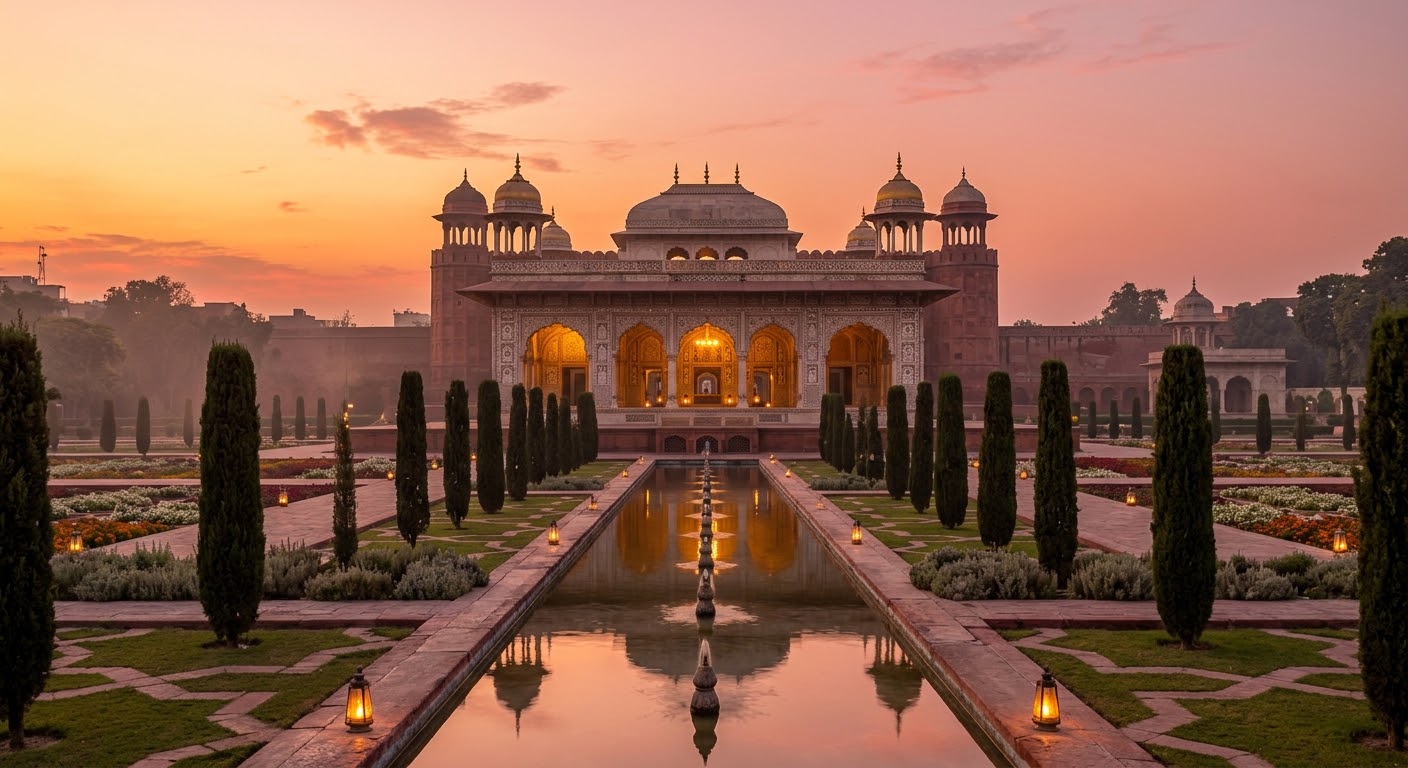
UNESCO inscribed: Protected: Punjab Special Premises Ordinance 1985This property combines the royal defensive bastion of Lahore Fort with the three-stage descending terraces of Shalimar Gardens, showcasing the absolute height of Mughal artistic and engineering mastery. The Lahore Fort contains Akbar's thick brick fortifications, Jahangir's court architecture, and Shah Jahan's white marble Shish Mahal. The Shalimar Gardens, built by Shah Jahan in 1642, features an elaborate, gravity-fed hydraulic network of 410 fountains feeding sandstone canals and reflecting pools across three symmetrical terraces.
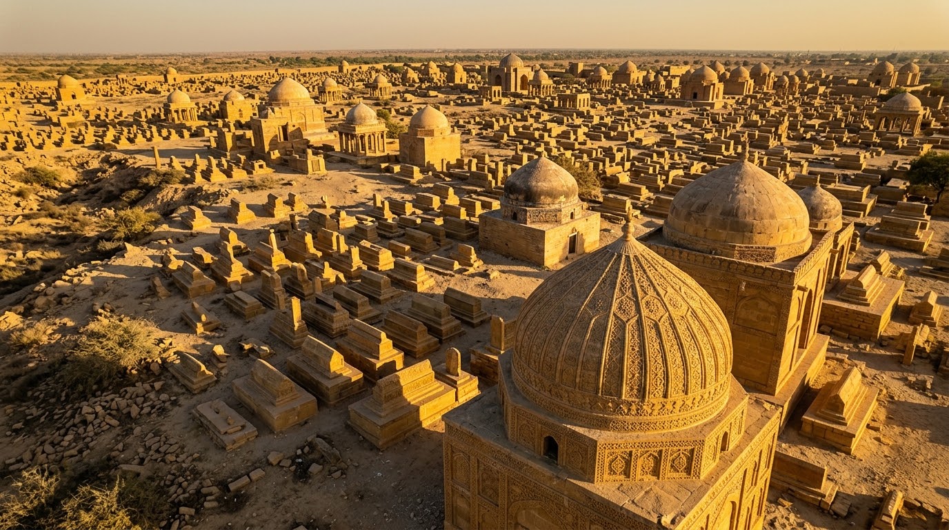
Historical Monuments at Makli, Thatta
UNESCO inscribed: Protected: Sindh Cultural Heritage Act 1994Spanning over 1,000 acres, the massive necropolis of Makli is one of the largest funerary landscapes in the world, holding approximately half a million graves. The site contains the monumental yellow sandstone tombs of Samma, Arghun, Tarkhan, and Mughal-era rulers. Makli is celebrated for its exquisite, lace-like low-relief stone carvings featuring geometric star lattices and floral patterns cut deeply into sandstone walls, alongside vibrant cobalt-blue glazed tilework that documents centuries of changing regional dynastic design.
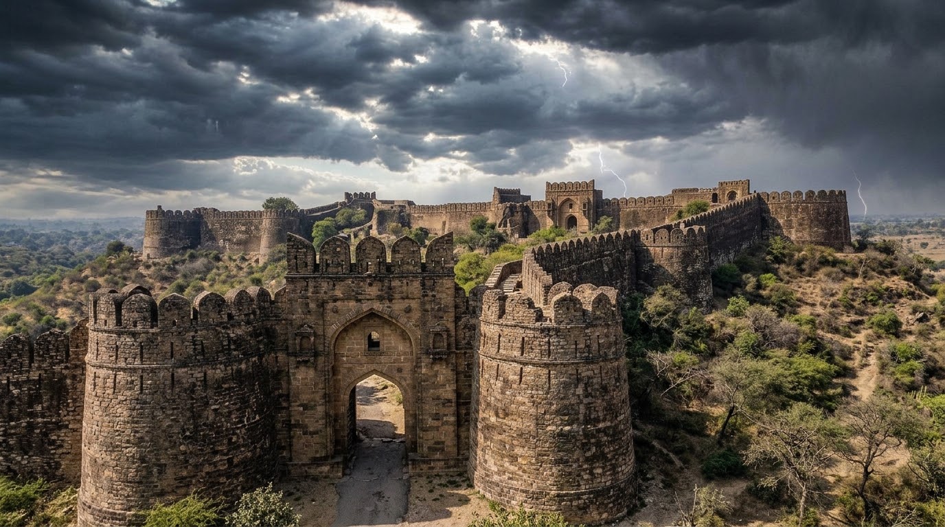
Rohtas Fort, Jhelum
UNESCO inscribed: Protected: Antiquities Act 1975Rohtas Fort is an exceptional, unconquered example of early Islamic military architecture in Central and South Asia, commissioned by Sher Shah Suri in 1541. Nestled along the rugged Potohar Plateau, the fortress features a massive 4-kilometer sandstone perimeter wall, reinforced by 68 semi-circular defensive bastions and 12 monumental gates—such as the majestic, carved Sohail Gate. Designed to control the strategic Grand Trunk Road and local Gakkhar tribes, the fort's robust layout served as a model for later Mughal military fortifications.
Tentative List sites (29)
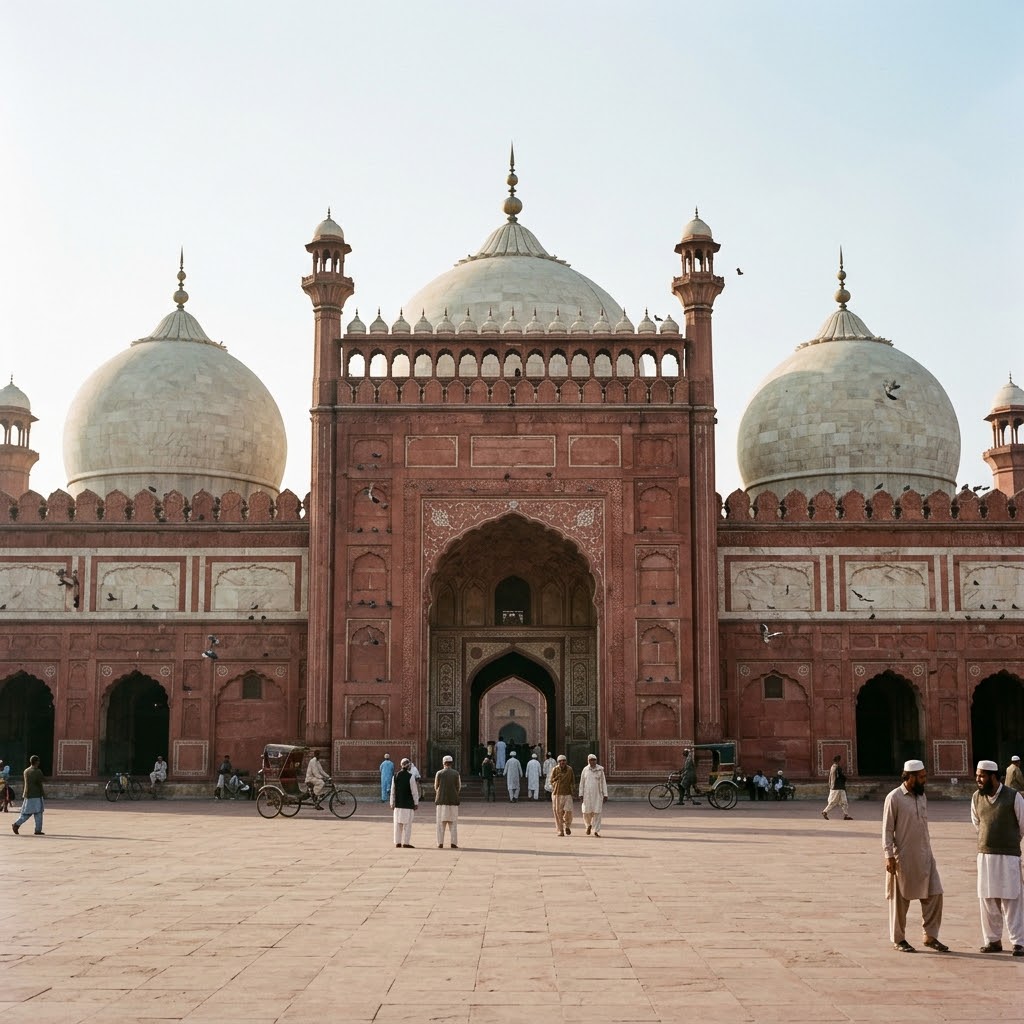
Badshahi Mosque, Lahore
UNESCO tentative: Reported protection: Punjab Special Premises Ordinance 1985Commissioned by the Mughal Emperor Aurangzeb in 1671 and completed in 1673, the Badshahi Mosque represents the monumental culmination of late-Mughal congregational architecture. Built primarily of red sandstone brought from Rajasthan, the prayer chamber features three massive white marble bulbous domes and is flanked by four soaring corner minarets rising 176 feet high. Its immense courtyard, capable of holding over 100,000 worshippers, is detailed with delicate sandstone relief carvings and geometric marble inlays.
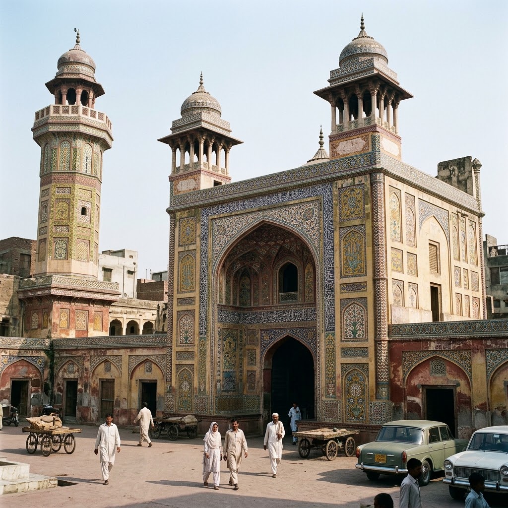
Wazir Khan's Mosque, Lahore
UNESCO tentative: Reported protection: Punjab Special Premises Ordinance 1985Built in 1634 under the reign of Emperor Shah Jahan, the Wazir Khan Mosque is renowned as the masterpiece of Mughal-era ceramic ornamentation. The mosque features a traditional rectangular plan centered around a spacious brick courtyard, with its exterior completely sheathed in vibrant, highly durable kashi-kari (glazed tile mosaics) depicting intricate floral and calligraphic panels. The interior walls are covered with luminous fresco-buono (true fresco) paintings applied directly onto freshly laid wet lime plaster.
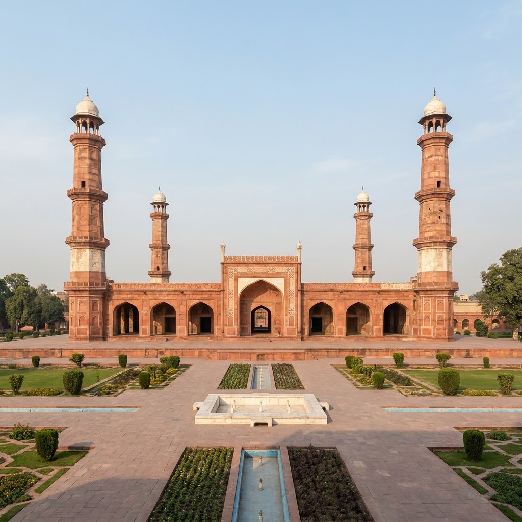
Tombs of Jahangir, Asif Khan and Akbari Sarai, Lahore
UNESCO tentative: Reported protection: Antiquities Act 1975This imperial funerary complex on the Ravi River combines Jahangir's flat-roofed sandstone tomb, Asif Khan's high-domed brick mausoleum, and the 180-celled Akbari Sarai. Jahangir's tomb is a single-story square pavilion clad in red sandstone with extensive white marble floral inlay and towering corner minarets. It stands as a monument to symmetrical Mughal garden-planning, bisected by geometric water channels.
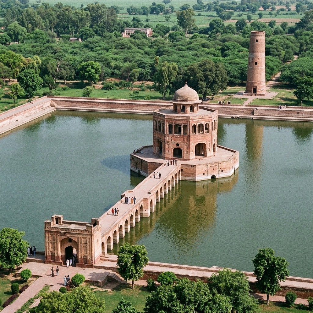
Hiran Minar and Tank, Sheikhupura
UNESCO tentative: Reported protection: Antiquities Act 1975Constructed under Emperor Jahangir as a royal hunting retreat and memorial for his favorite antelope, Mansraj, this complex represents an early 17th-century engineering marvel. It features a massive rectangular, brick-lined water tank with a central octagonal royal pavilion accessed by a long masonry causeway. The complex is anchored by a 108-step brick minar tower detailed with plaster frescoes, which served as a landmark for royal game keepers.
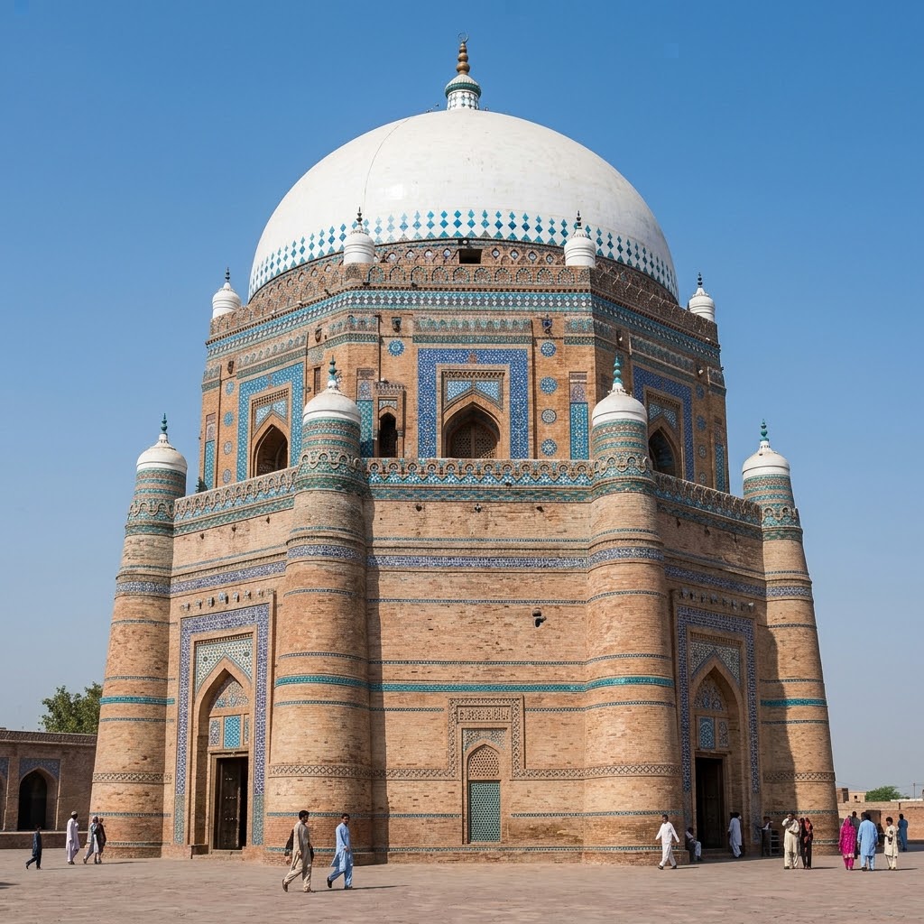
Tomb of Shah Rukn-e-Alam, Multan
UNESCO tentative: Reported protection: Antiquities Act 1975Built between 1320 and 1324 under Ghiyath al-Din Tughluq, this monumental octagonal tomb is the premier masterpiece of Tughlaq-era military-style funerary architecture. Rising 115 feet high, its steeply sloping walls are constructed of red kiln-burnt bricks reinforced internally by massive timber frames to absorb seismic shocks. The exterior features bands of vibrant Multani blue and white glazed tile mosaics, hand-cut relief brickwork, and a colossal white hemispherical dome visible across the Multan plains.
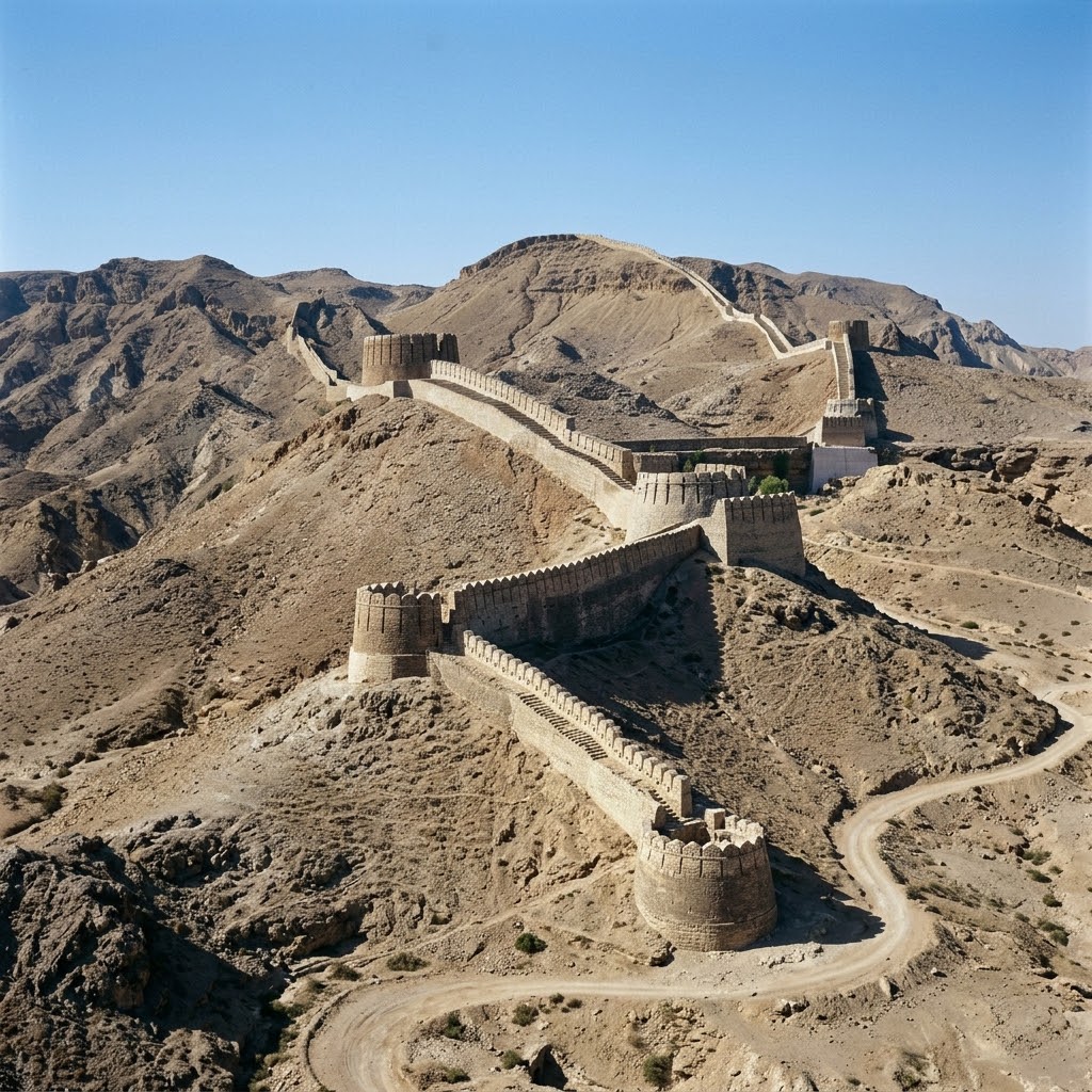
Rani Kot Fort, Dadu
UNESCO tentative: Reported protection: Antiquities Act 1975Acclaimed as the "Great Wall of Sindh," Rani Kot is the largest fort in the world, snaking across a 32-kilometer perimeter. Constructed of local dressed limestone blocks, the walls strictly conform to the jagged topographies of the arid Kirthar Range. The fortress features semi-circular defensive bastions and houses two internal strongholds, Miri Kot and Shergarh, which served as royal defensive residencies for Sindh's Talpur rulers in the 19th century.
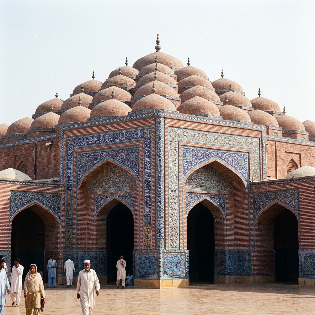
Shah Jahan Mosque, Thatta
UNESCO tentative: Reported protection: Antiquities Act 1975Commissioned by Emperor Shah Jahan in 1647 as a gift of gratitude to the people of Thatta, this monumental red-brick mosque features an extraordinary layout of 93 domes. Constructed without minarets, the mosque is engineered for acoustic resonance, allowing a whisper in one dome to be heard across the entire courtyard. Its vaults and domes are covered in the most elaborate Persian-Timurid style mosaic tile-work in South Asia, decorated with brilliant cobalt-blue, turquoise, and white floral star patterns.
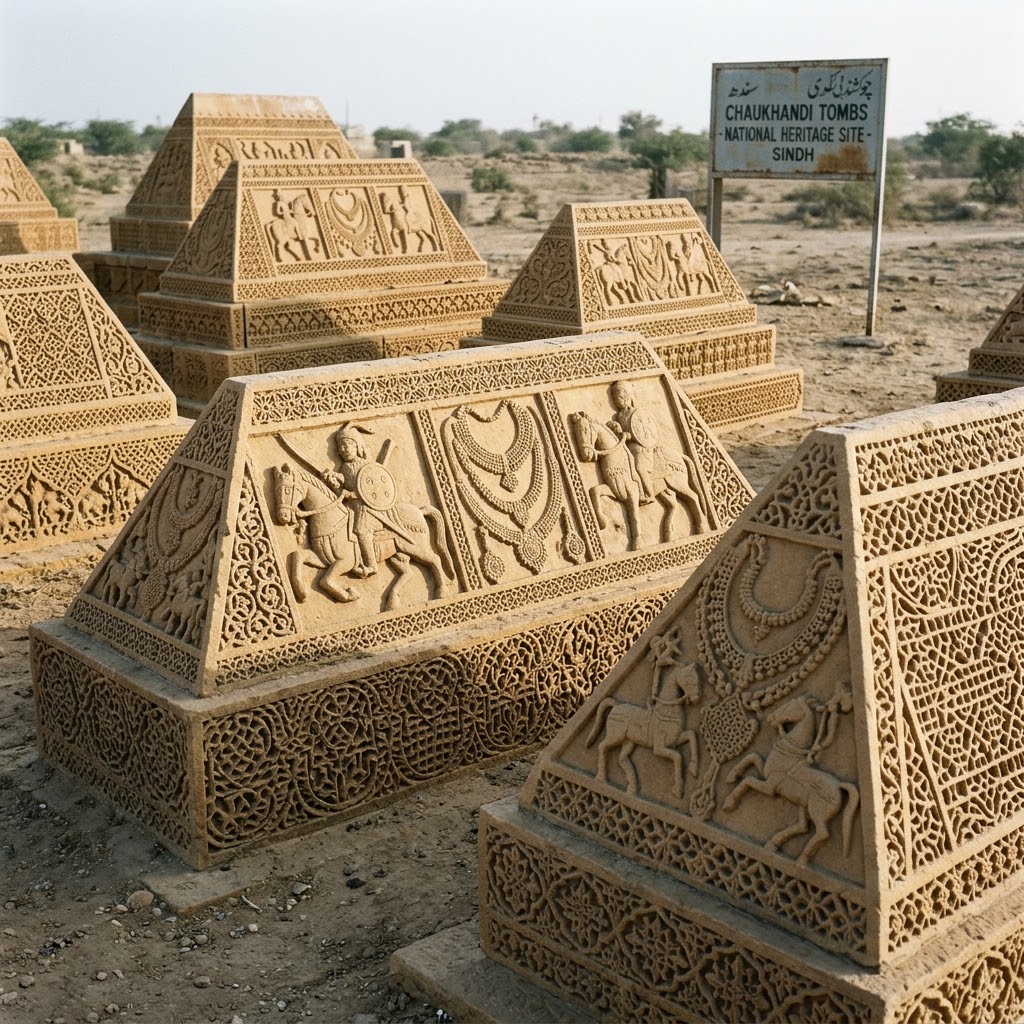
Chaukhandi Tombs, Karachi
UNESCO tentative: Reported protection: Antiquities Act 1975Dating to the 17th and 18th centuries, Chaukhandi is a sprawling tribal necropolis built for the warriors and families of Baloch and Jokhio clans. The tombs are constructed from local yellow sandstone blocks, arranged in multi-tiered pyramidal shapes. Each tomb is densely decorated with fine, low-relief geometric and figurative carvings depicting weapons, horses, and warriors for male graves, and delicate jewelry, anklets, and woven textiles for female graves.
Archaeological Site of Mehrgarh
UNESCO tentative: Reported protection: Antiquities Act 1975Mehrgarh is one of the most critical prehistoric archaeological sites in South Asia, documenting the birth of agriculture and permanent community living (circa 7000–2500 BCE). Situated on the Kacchi Plain, excavations uncovered deep aceramic Neolithic layers containing multi-room mud-brick dwellings, specialized compartmented granaries designed for agricultural grain storage, and early cemeteries containing extensive grave goods, including shell, turquoise, and lapis lazuli beads shaped with stone micro-drills.
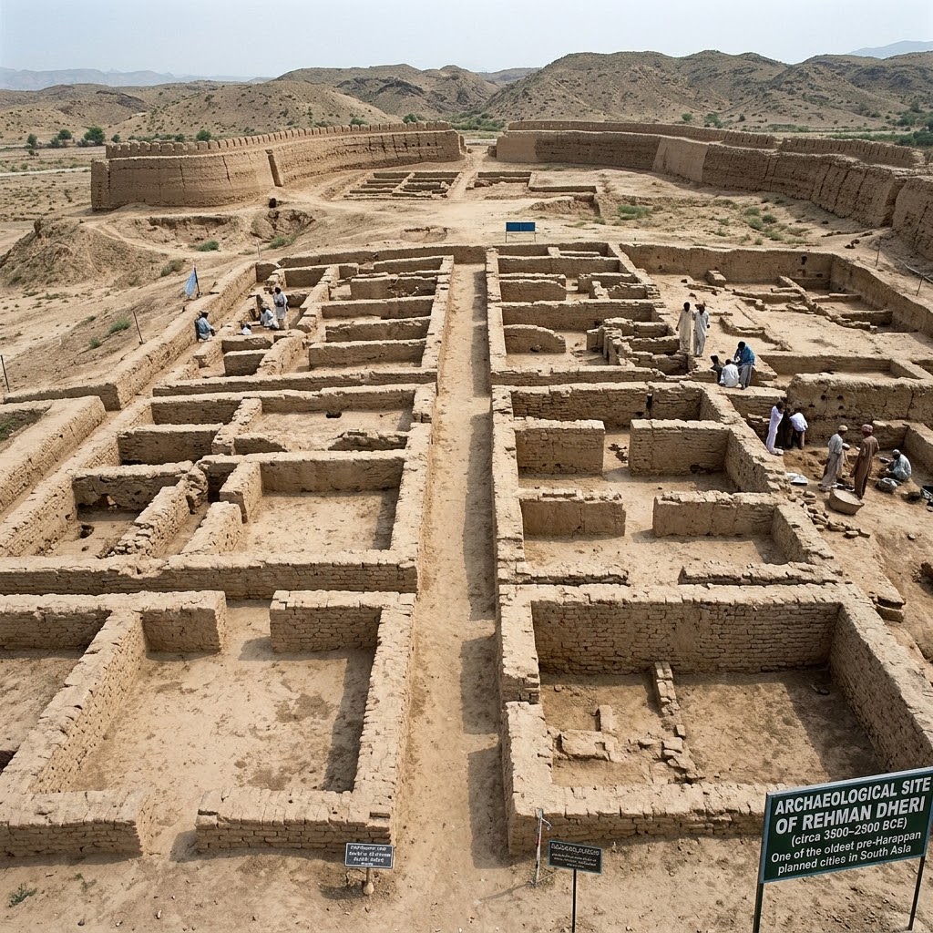
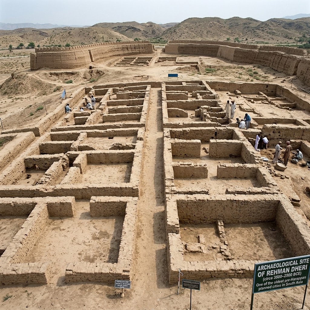
Archaeological Site of Rehman Dheri
UNESCO tentative: Reported protection: Antiquities Act 1975Dating from 3500 to 1900 BCE, Rehman Dheri is one of the earliest and most complete planned urban settlements in South Asia. This massive pre-Harappan tell is enclosed by a rectangular clay fortification wall and bisected by a straight central street with perpendicular lanes, forming a perfect gridiron layout. The site was abandoned during the mature Harappan phase, perfectly preserving early pottery kilns, bead workshops, and pottery shards incised with early graffiti scripts.
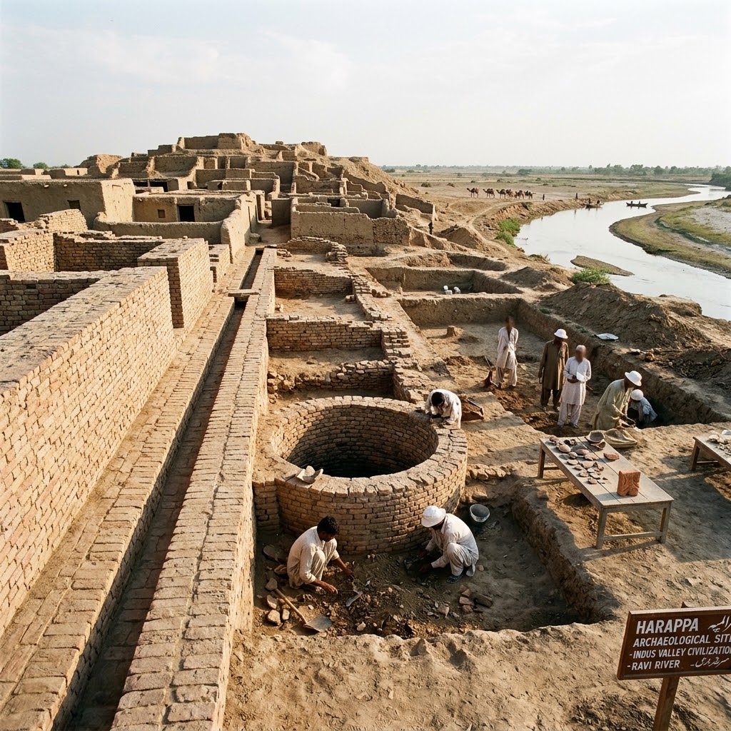
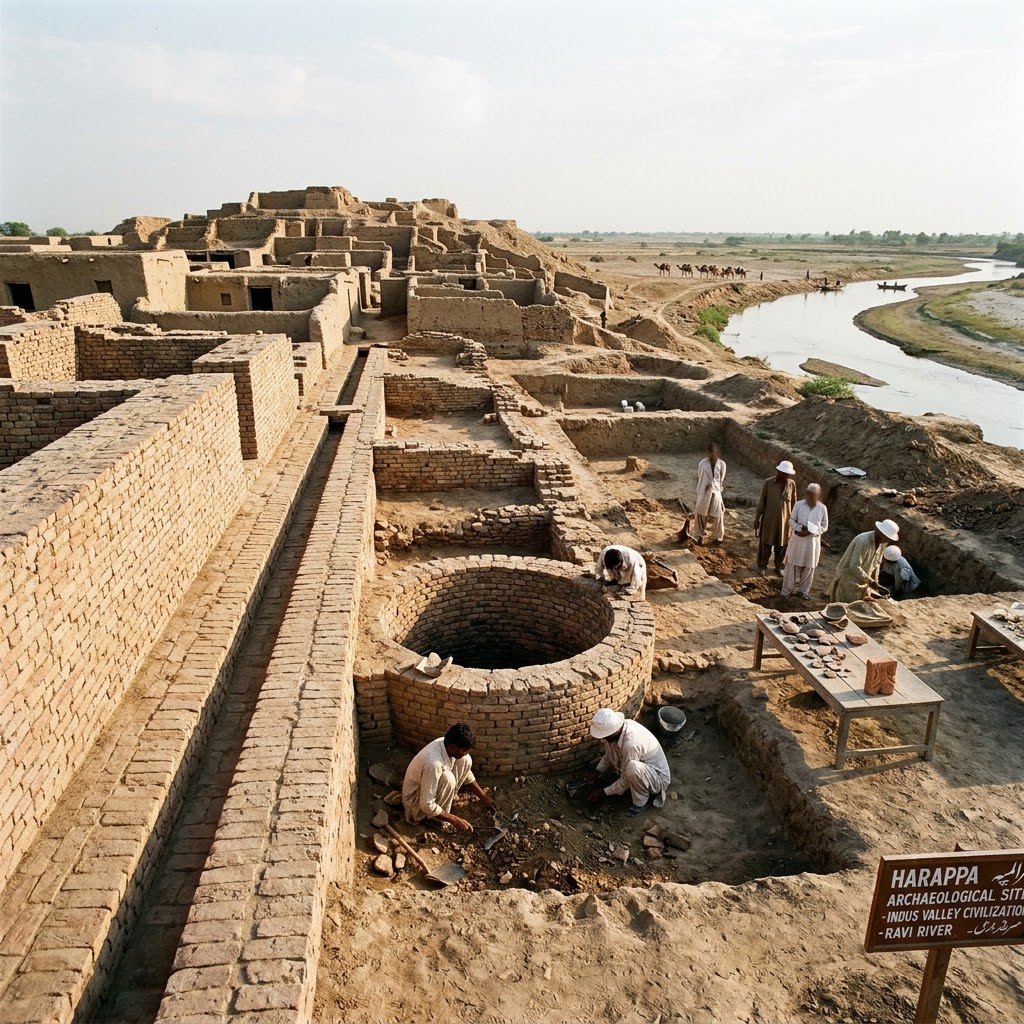
Archaeological Site of Harappa
UNESCO tentative: Reported protection: Antiquities Act 1975As the twin capital of the mature Indus Valley Civilization, Harappa stands as a monument to early municipal sanitation and advanced riverine trade. Occupied from the late 4th to mid-2nd millennium BCE along the old bed of the Ravi River, the site includes several massive tells, defensive walls, and residential sectors. Harappa's civic infrastructure is defined by its wedge-shaped brick water wells, complex subterranean street sewers, and public granaries engineered for flood protection.
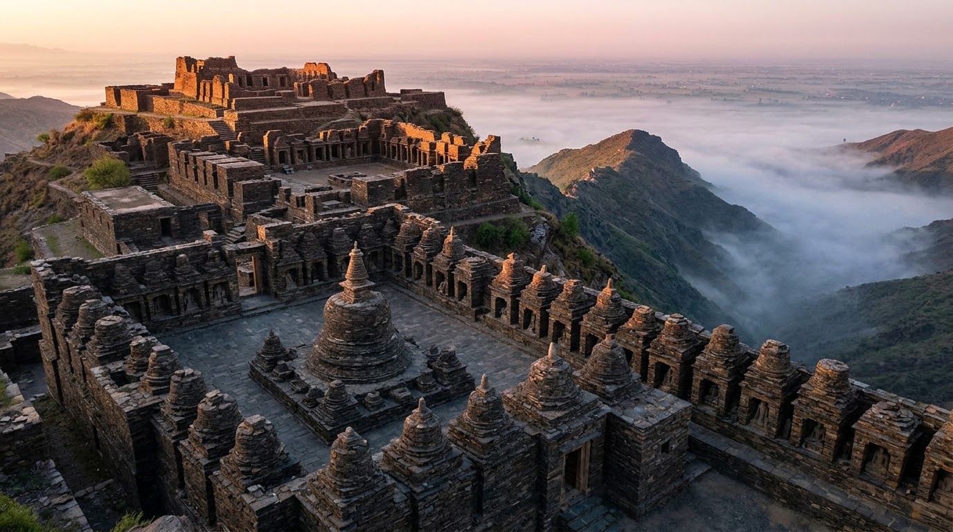
Archaeological Site of Ranigat
UNESCO tentative: Reported protection: KP Antiquities Act 2016Ranigat is the largest and most complete Gandharan Buddhist monastic complex in the Buner region, flourishing between the 1st and 6th centuries CE. Perched on a steep granite ridge, the monastery features massive, dry-stone masonry terraces built of gray schist. The complex contains a central court of stupas, secondary shrines, vaulted prayer cells, and rock-cut pathways, illustrating the architectural integration of spiritual spaces within high-altitude landscapes.

Shahbazgarhi Rock Edicts
UNESCO tentative: Reported protection: Antiquities Act 1975Carved into two massive natural granite boulders in the 3rd century BCE, the Shahbazgarhi edicts are some of the oldest irrefutable records of writing in South Asia. Commissioned by the Mauryan Emperor Ashoka, the inscriptions are written cleanly in the ancient, flowing Kharosthi script from right to left. The texts detail Ashoka's core tenets of righteous law, peace, non-violence, and tolerance, acting as a permanent code of conduct along the ancient Silk Road routes.
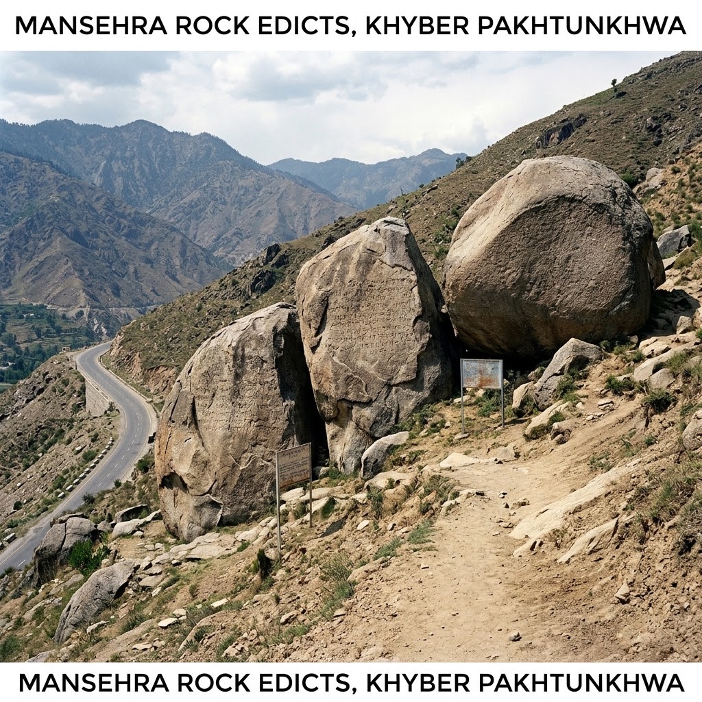
Mansehra Rock Edicts
UNESCO tentative: Reported protection: Antiquities Act 1975The Mansehra rock edicts comprise fourteen imperial inscriptions carved into three large natural granite boulders under Mauryan Emperor Ashoka in the 3rd century BCE. Written in the local Kharosthi script, they describe the ethical and administrative principles of Ashoka's rule. Perched beside the ancient route that today connects Punjab to the high Karakoram passes, the boulders are protected by brick pavilions to shield them from environmental weathering and highway traffic.
Baltit Fort
UNESCO tentative: Heritage protection unverifiedOverlooking the Hunza Valley trade routes, Baltit Fort is a historic 8th-century palace showing distinct Tibetan-style architectural design. The three-story fort is constructed of raw stone and mud mortar, reinforced with heavy interlocking timber frames designed to absorb earthquake shocks along active tectonic fault-lines. The fortress served as the continuous military and administrative residence of the Mir (rulers) of Hunza until 1945.
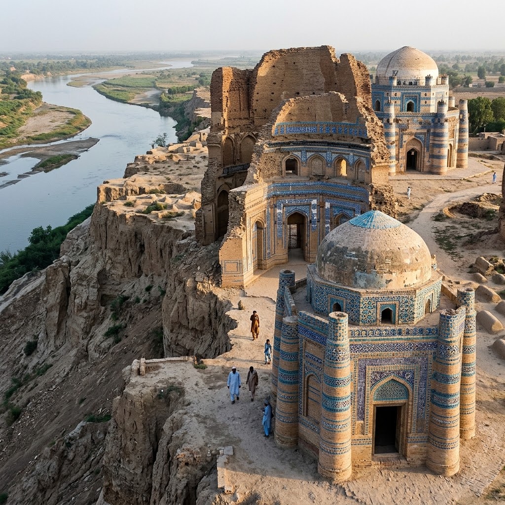
Tombs of Bibi Jawindi, Baha'al-Halim and Ustead, Uch Sharif
UNESCO tentative: Reported protection: Antiquities Act 1975This highly endangered site in Uch Sharif features five monumental 14th-to-15th-century Sufi shrines and mosques, headlined by the octagonal Tomb of Bibi Jiwandi. Built of red brick on horizontal wooden tie-beams, the shrines are decorated with breathtaking glazed tile mosaics in turquoise and deep cobalt blue. Half of Bibi Jiwandi's tomb collapsed during severe seasonal river flooding, exposing the exquisite geometric brick-and-timber engineering.
Port of Banbhore
UNESCO tentative: Reported protection: Antiquities Act 1975Banbhore preserves the archaeological remains of ancient Daybul, the 8th-century port city captured by the Arab general Muhammad bin Qasim in 711 CE. Excavations uncovered the limestone foundations of one of the earliest mosques in South Asia (dating to 727 CE), containing recycled sandstone blocks from an underlying pre-Islamic Shiva temple. Situated at the old mouth of the Indus River, the port was an industrial workshop hub for metalworking, glass making, and ivory carving.
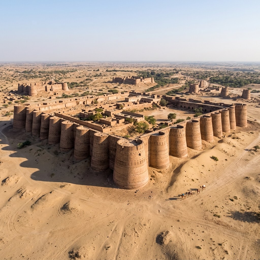
Derawar and the Desert Forts of Cholistan
UNESCO tentative: Reported protection: Punjab Special Premises Ordinance 1985This desert defense network comprises ten forts built to secure caravan and pilgrimage routes across the Cholistan Desert. The central stronghold is Derawar Fort, built in the 9th century by Rajput clans and extensively rebuilt in the 18th century by the Nawabs of Bahawalpur. The fort features forty colossal, semi-circular baked-brick bastions rising 100 feet high out of the desert sands, forming an imposing defensive perimeter.
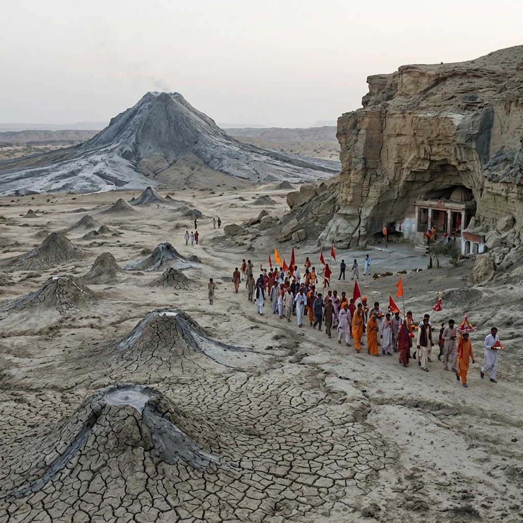
Hingol Cultural Landscape
UNESCO tentative: Environmental protection: Balochistan Wildlife ActHeritage protection unverifiedHingol is a unique cultural-natural landscape combining the sacred Hinglaj Mata cave temple, the craggy limestone bluffs of the Makran coast, and the active mud volcanoes of Chandragup. As a major pilgrimage center, the Hinglaj cave shrine attracts thousands of Hindu pilgrims annually who perform ritual walks across dry ravines. The landscape is defined by the massive Chandragup mud volcanic cones, revered as sacred geological features.
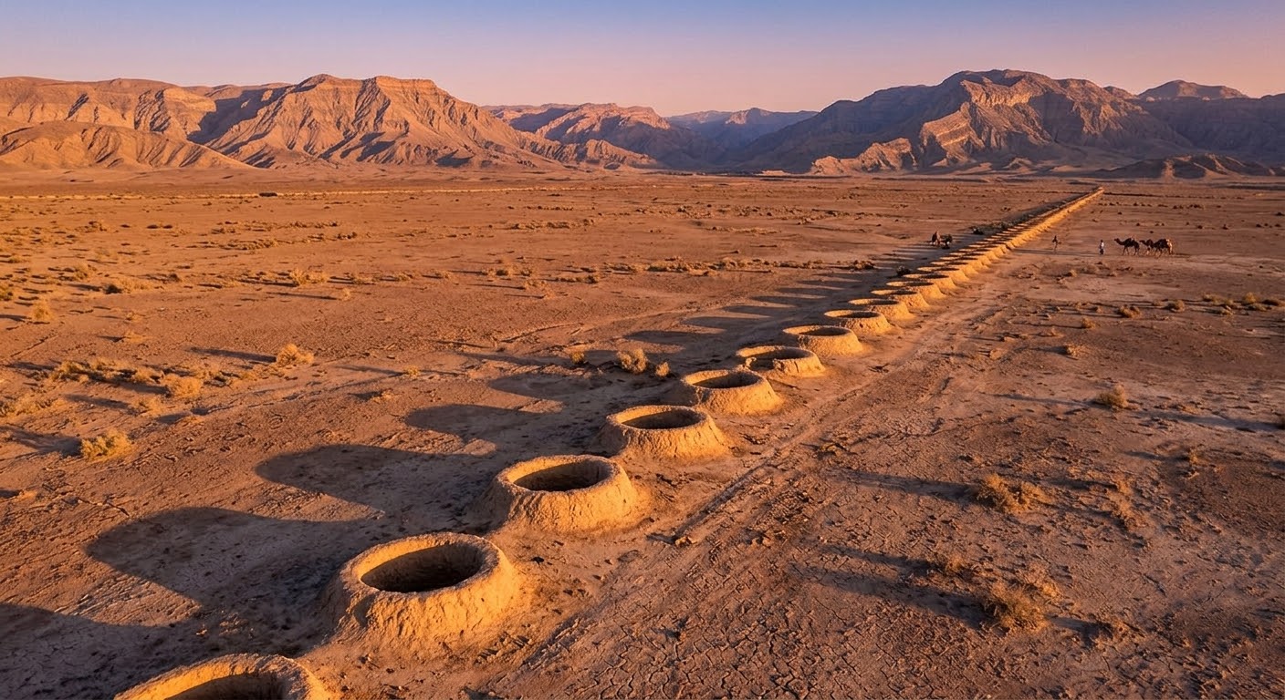
Karez System Cultural Landscape
UNESCO tentative: Heritage protection unverifiedThe Karez landscape preserves ancient, highly sustainable water engineering systems, utilizing underground gravity-driven aqueducts to tap into mountain water tables. Originating from ancient Persian qanat technologies, these channels run beneath the arid Balochistan valleys, transporting water to agricultural settlements. Operated cooperatively by local communities, these systems prevent water evaporation and enable agriculture in semi-arid zones.
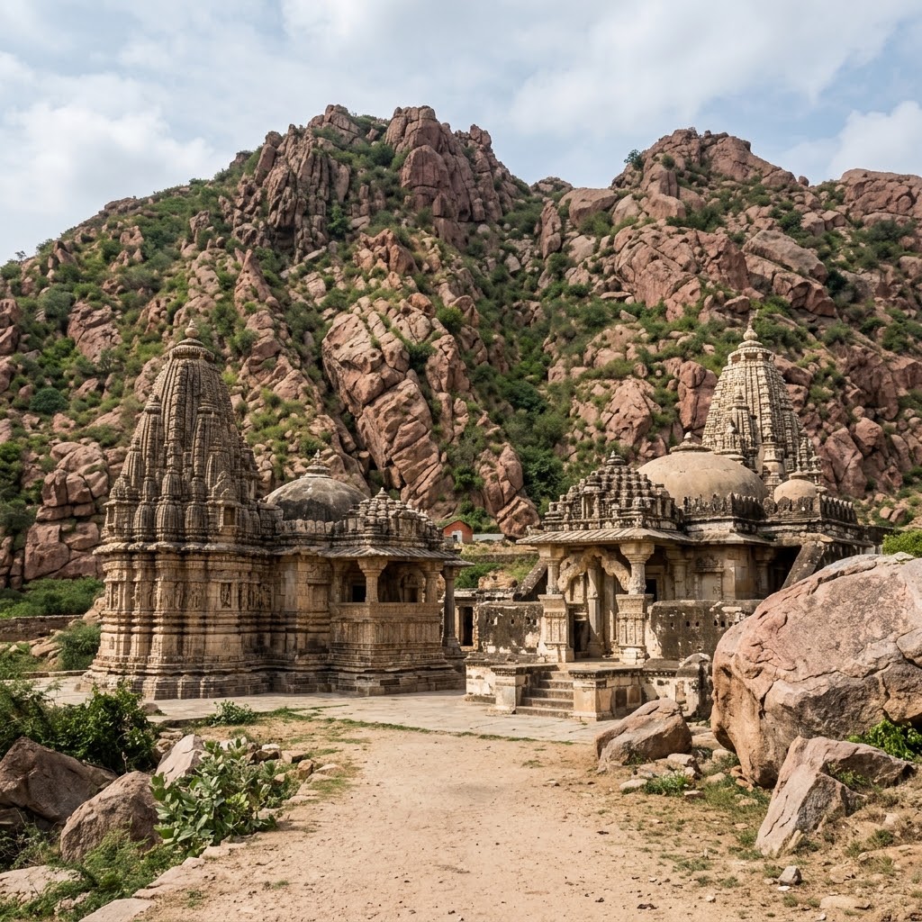
Nagarparkar Cultural Landscape
UNESCO tentative: Reported protection: Antiquities Act 1975Nagarparkar is a sacred cultural landscape located at the edge of the Thar Desert, defined by the pink granite peaks of the Karoonjhar Hills and a series of historic Jain temples dating from the 12th to 15th centuries. Headlined by the Gori Temple, these structures are constructed of local stone, plastered in white stucco, and decorated with delicate marble carvings. They stand as monuments to Sindh's medieval maritime trade networks.
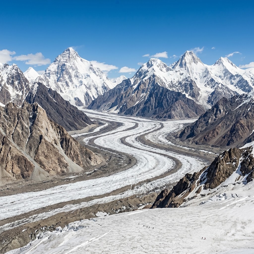
Central Karakoram National Park
UNESCO tentative: Environmental protection: GB National Parks ActCentral Karakoram is a high-altitude wilderness, encompassing some of the world's highest peaks, including K2 (8,611 meters), and massive glacial systems like the Baltoro Glacier. Geologically situated along the tectonic collision zone between the Indian and Eurasian plates, the park features towering granite cliffs and sheer rock walls. It serves as a critical refuge for endangered alpine mammals, including the snow leopard, markhor, and Himalayan brown bear.
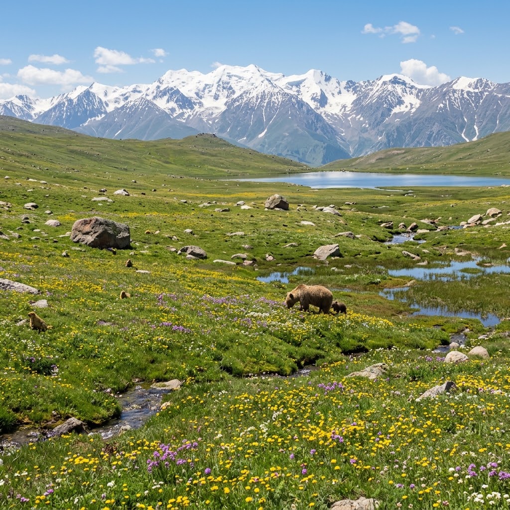
Deosai National Park
UNESCO tentative: Environmental protection: GB National Parks ActDeosai National Park is a high-altitude alpine plateau, averaging 4,114 meters in elevation, situated at the meeting point of the Himalayan and Karakorum-Pamir ecoregions. The landscape is characterized by rolling plains, marshy wetlands, and the pristine alpine Sheosar Lake. Due to its isolated, fragile ecosystem, Deosai is a critical sanctuary for the endangered Himalayan brown bear, Tibetan wolf, and golden marmot.
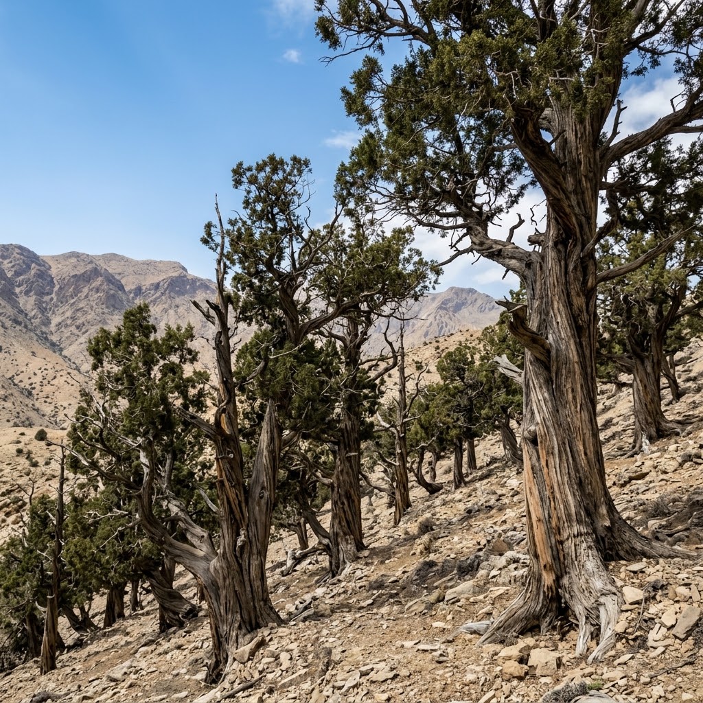
Ziarat Juniper Forest
UNESCO tentative: Environmental protection: State Forest ReservesThe Ziarat Juniper Forest is one of the oldest and largest Juniperus excelsa ecosystems in the world, with trees estimated to be several thousands of years old. Situated at the meeting point of five distinct vegetation zones in Balochistan's dry mountain basins, this fragile forest is home to the Balochistan black bear, markhor, and various endemic medicinal plants. This ancient woodland is highly vulnerable to climate change and human pressures.
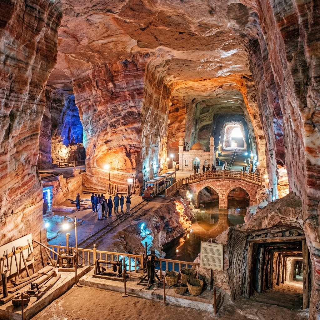
The Salt Range and Khewra Salt Mine
UNESCO tentative: Heritage protection unverifiedThe Salt Range is a unique geological formation containing thick deposits of pink halite (rock salt) that formed 800 million years ago. This range provides an exceptional record of geological layers from the Cambrian to the Paleogene, rich in ancient fossils. The complex includes the historic Khewra Salt Mine, operating continuously since its discovery during Alexander the Great's campaign in 326 BCE, featuring massive hand-carved chambers and salt-block tunnels.
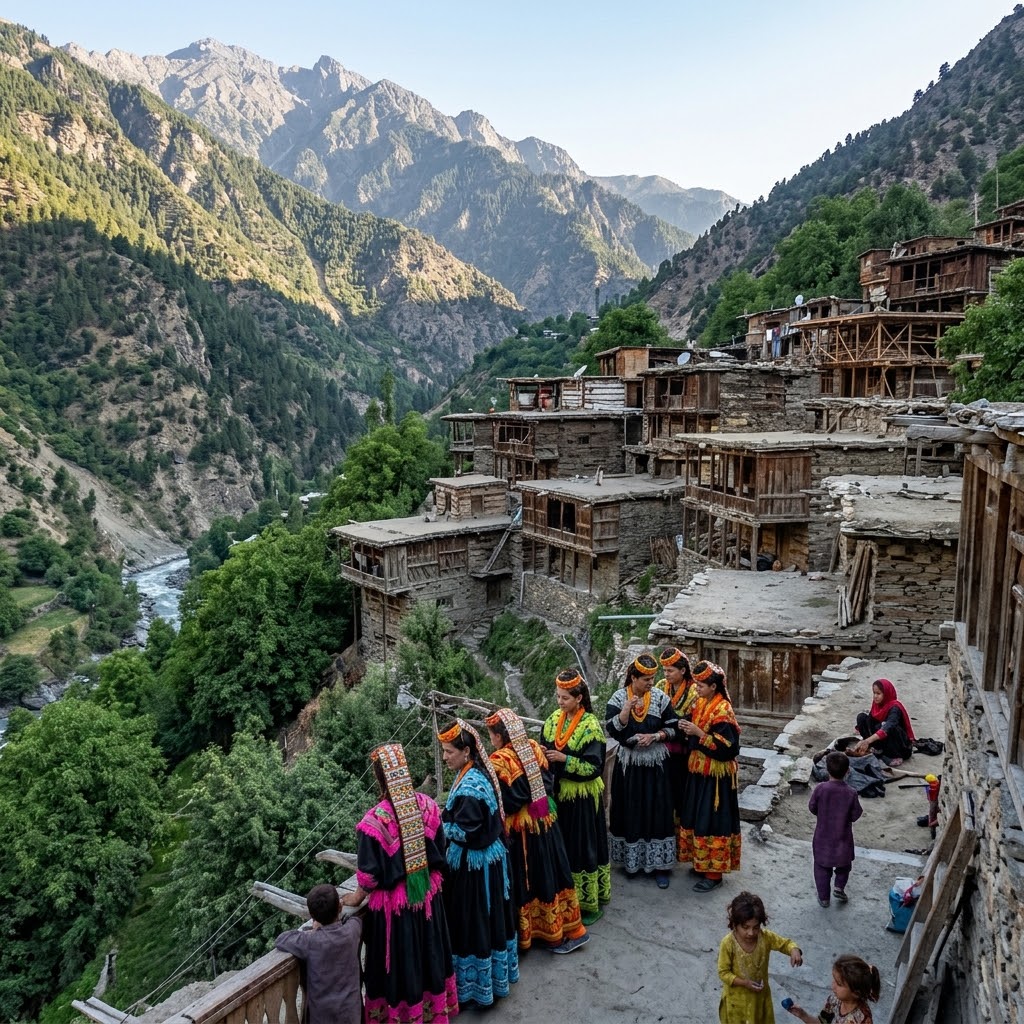
Kalasha Valley Cultural Landscape
UNESCO tentative: Reported protection: KP Antiquities Act 2016Added to the Tentative List in 2026, the Kalasha Valleys of Bumburet, Birir, and Rumbur are home to an indigenous community practicing unique polytheistic traditions. The cultural landscape features traditional wooden architecture of interlocking pine logs and stone dry-masonry stacked up steep mountain slopes. The valleys are celebrated for their living traditions, seasonal festival dances, and the "Suri Jagek" astronomical observation system used to track solar alignments.
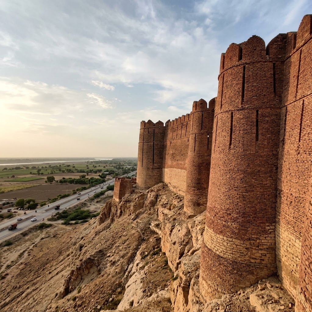
Kot Diji Fort
UNESCO tentative: Reported protection: Antiquities Act 1975Added to the Tentative List in 2026, Kot Diji is a monumental military fortress constructed of solid kiln-burnt bricks on a steep limestone ridge. Built by the Talpur Mirs in the 18th century, the fort features towering semi-circular bastions and crenellated battlements snaking across the ridge. Directly below these ramparts lie the excavations of the 4th-millennium BCE pre-Harappan Kot Dijian citadel, illustrating the site's continuous strategic significance across five millennia.
Naukot Fort
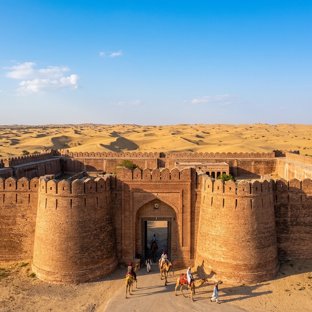
UNESCO tentative: Reported protection: Sindh Cultural Heritage Act 1994Added to the Tentative list in 2026, Naukot Fort is a highly engineered brick fortress built by the Talpur Mirs in 1814 on the edge of the Thar Desert. Known as the "Gateway to the Thar Desert," the fortress is constructed of heavy, small baked bricks and features a monumental arched gateway flanked by massive semi-circular bastions. The fort served as a defensive military garrison to secure border trade routes and control local desert clans.
Umerkot Fort
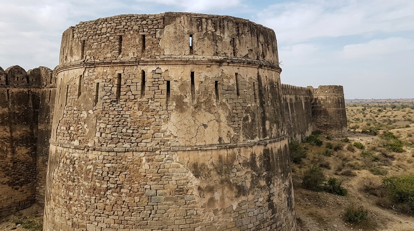
UNESCO tentative: Reported protection: Antiquities Act 1975Added to the Tentative List in 2026, Umerkot Fort is a desert stronghold dating back to the medieval Sumra dynasty, with subsequent brick-built modifications by the Kalhoras and Talpurs. The fort is famous as the birthplace of the Mughal Emperor Akbar in 1542, who was born there during his father Humayun's desert exile. Its massive, weathered red-brick walls and arched gateway stand as a testament to the fort's strategic military history.
Verify the Shah Rukn-e-Alam Tentative submission year (shown as 1993) against whc.unesco.org/en/statesparties/pk before publishing.