
Heritage record
Shatial Bridge Rock Carvings
Khyber PakhtunkhwaRock ArtProtected
Shatial Bridge is located 60 kilometers west of Chilas in the upper Indus Valley beside the Indus River in Gilgit-Baltistan. Historically it acted as a junction of old routes and by ways connecting Swat Valley, Gilgit, Chilas, and Chitral. As a historical crossroads, many traders, Buddhist missionaries, Sogdian merchants, and pilgrims passed through Shatial leaving behind graffiti and inscriptions on the rocks. More than 1000 inscriptions and 700 petroglyphs can be found at the Shatial bridge on the Indus River. Iranian merchants left behind over 550 inscriptions dating from third to seventh centuries in the Sogdian language, nine in the extinct Bactrian language, and two in Middle Persian and Parthian each. Many of these inscriptions are short, consisting of just the names of the travelers, though in some cases names of two or more family members are also mentioned. Many inscriptions also mention a date, possibly of arrival, but it is unknown whether this refers to the date or year of journey. These Iranian inscriptions are significant in providing insight on the naming traditions of Sogdian of the time as some of these are the ophoric referring to Zoroastrian and other deities. Though these inscriptions do not establish an exact date or period, it is believed that most of them belong to the Sasanian period (224-651 CE). Scripts and graffiti in ancient Brahmi and Kharosthi languages are found on the rocks revealing that the place also served as a Buddhist shrine. The Buddhist travelers venerated these inscriptions and artwork, particularly a large triptych with drawings of astupaand Sibi Jataka.
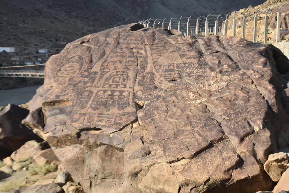
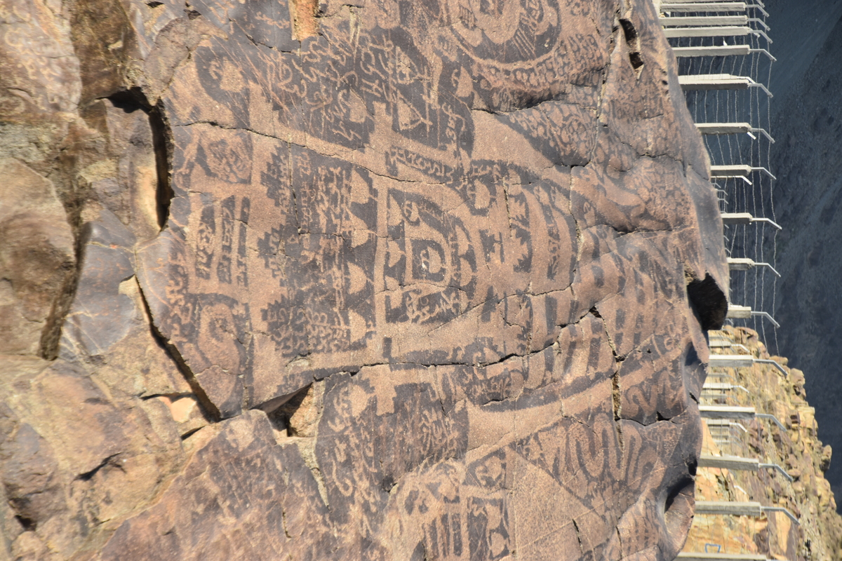
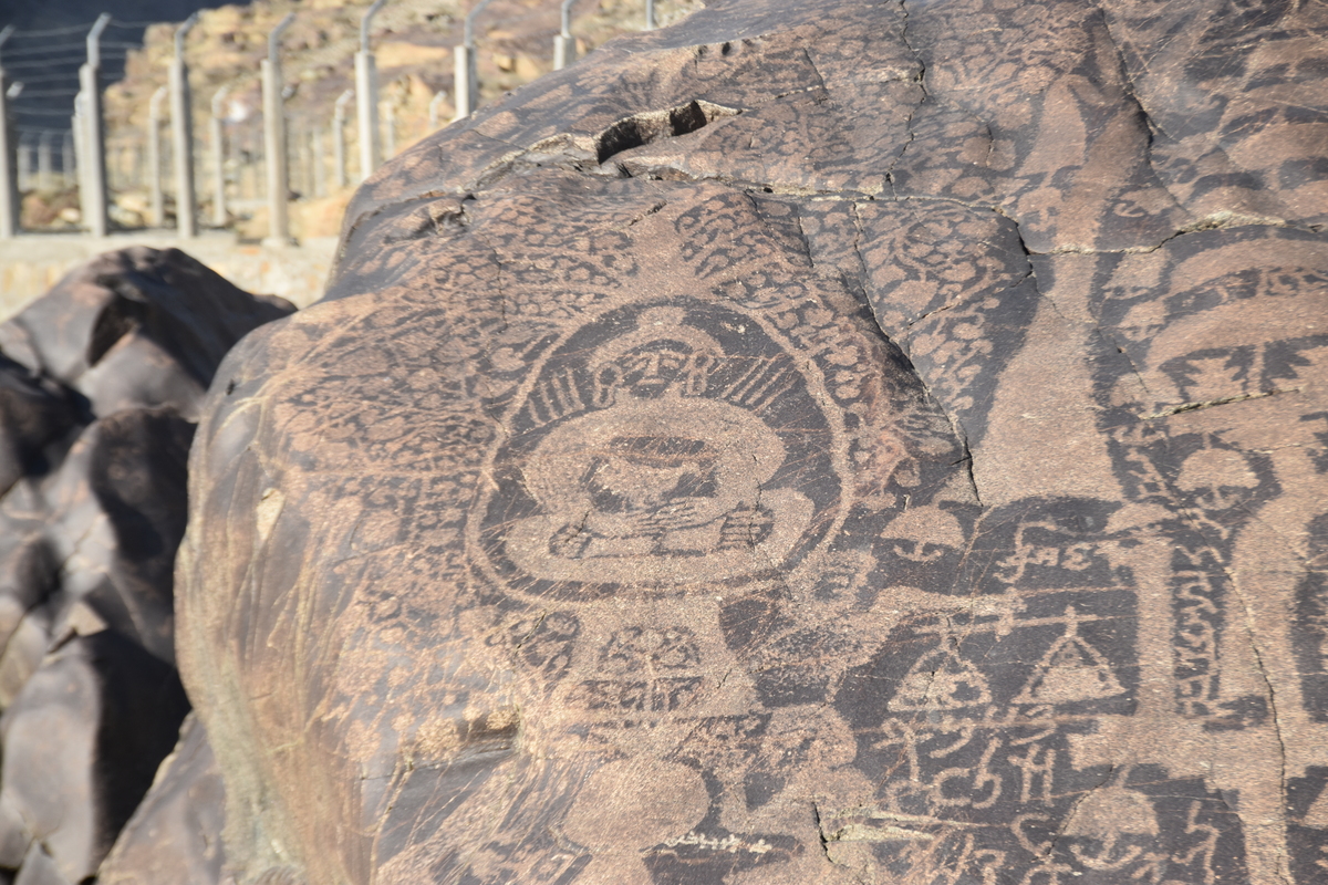
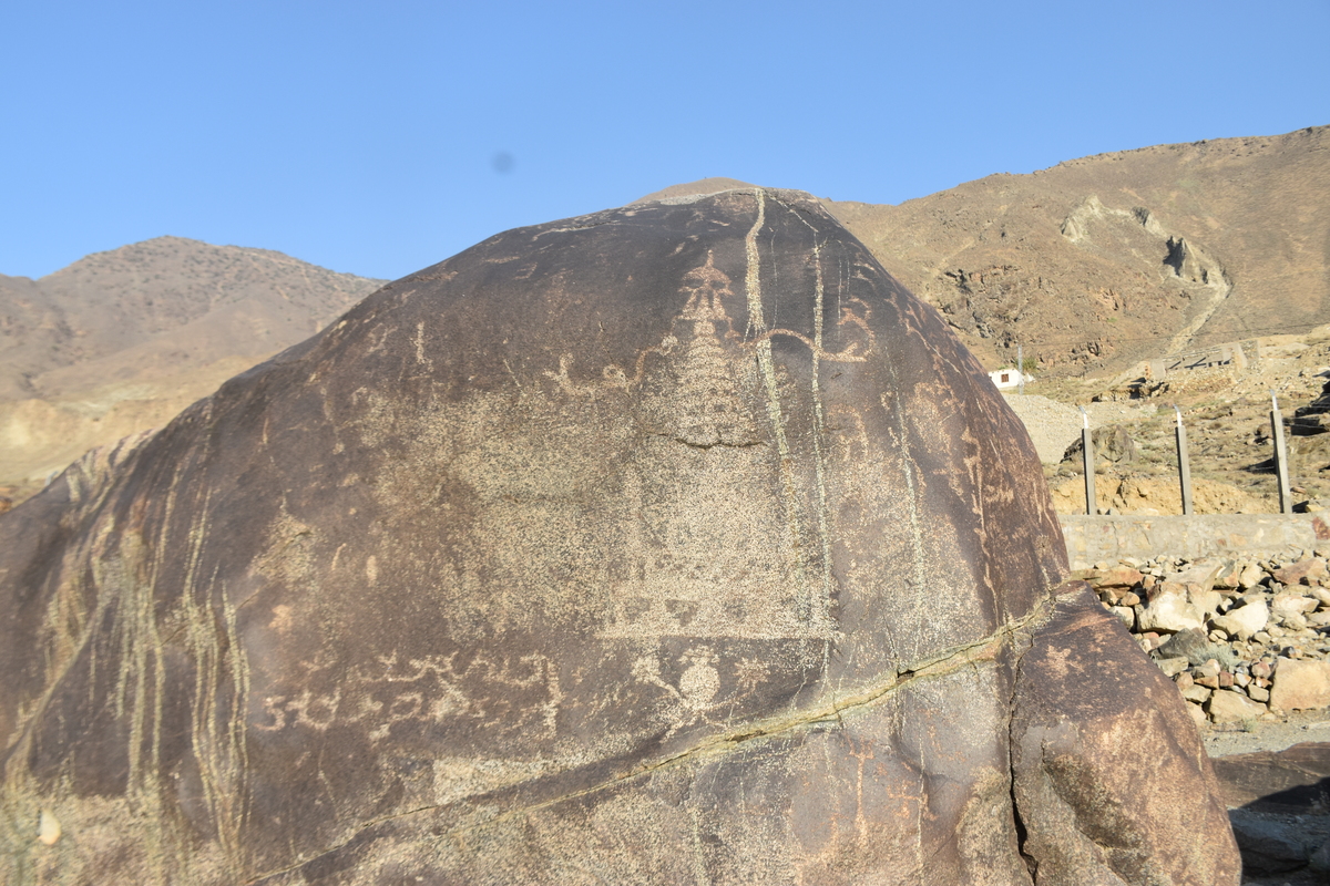
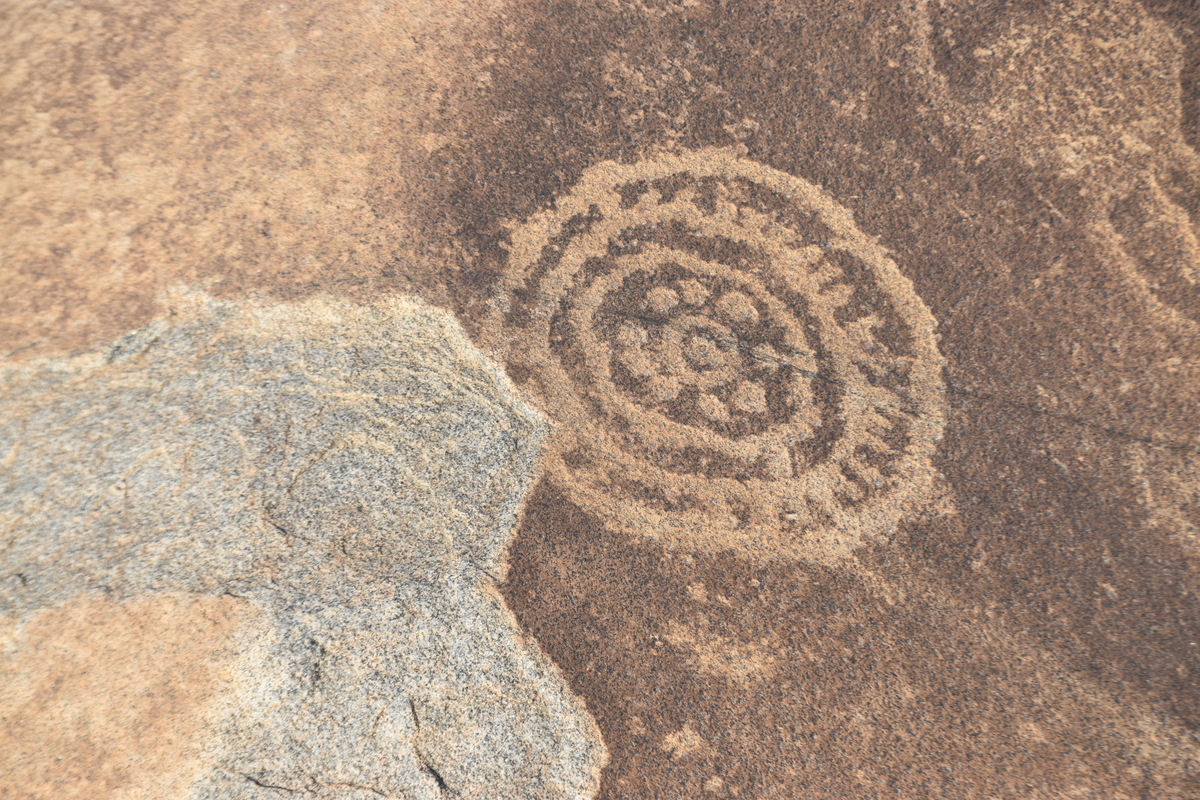
Photographs: Department of Archaeology & Museums national inventory record, displayed from the official source (doam.gov.pk). Not PWHI photography.
- Record ID
- 10378
- Province / territory
- Khyber Pakhtunkhwa
- District
- Diamir
- Typology
- Archaeological Site
- Subtype
- Rock Art
- Period
- Historic
- Legal status
- Not Protected — UNVERIFIED; no statute or notification cited
- Coordinates
- 35.52694, 73.54333 — source-provided, not field-verified
- Verification status
- source_record; automatically_standardized; verification_required
- Sources
- Anonymous. (Miscellaneous). Miscellaneous. Miscellaneous.
Found an error in this record? Submit a correction — quote record ID 10378.
Pakistan's Heritage Digital Ecosystem: Heritage Atlas · PWHI · Visual Record · Forum