
Heritage record
Mohenjo Daro
SindhSettlementWorld Heritage propertyProtected
The Moenjodaro is located on the right bank of the Indus River and lies about 80 km southwest of Sukkar. The archaeological ruins of Moenjodaro are located on the right bank of the Indus River 28 km from Larkana city and 7 km away in southeast of the Dokri town. Mohenjo-daro, also spelled Mohenjodaro or Moenjodaro depicts the remains of the Bronze Age of Pakistan and represents the peak period or mature phase of the Indus Valley Civilization. The name Mohenjo-daro is reputed to signify “the mound of the dead.” Because of the city’s size—about 5 km in circuit—and the comparative richness of its monuments and their contents, it has been generally regarded as a capital of an extensive state. The central block on the western side has been built up artificially that has survived to a dominating height of 6 to 12 metres with mud and mud brick and was fortified to an unascertained extent by square towers of baked brick. Buildings on the high summit included an elaborate bath or tank surrounded by a veranda, a large residential structure, a massive granary, and at least two aisled halls of assembly. It is clear that the citadel carried the religious and ceremonial headquarters of the site. In the lower town can be seen substantial courtyard houses indicating a considerable middle class. Most houses have small bathrooms and, like the streets, were well-provided with drains and sanitation. Brick stairs indicate at least an upper story or a flat, habitable roof. The walls were obviously originally plastered with mud. Aesthetically the most notable work of figurative art from the city is a famous bronze of a young dancing girl, naked save for a multitude of armlets. The Priest-King or King-Priest - a small male figure sculpted in steatite, "the most famous stone sculpture" of the Indus Valley Civilization now in the collection of the National Museum of Pakistan, Karachi depicts a neatly bearded man with a fillet around his head is very prominent. Among innumerable terra-cottas the most expressive are small but vigorous representations of bulls and buffalo. Female figurines may wear elaborate headdresses, and occasional figurines of small, fat grotesques, male or female, betray what perhaps a crude sense of humor was. The important buildings at Moenjodar include:
(1) Citadel Area: A well-planned street grid and an elaborate drainage system hint that the occupants of the ancient Indus civilization city of Mohenjo Daro were skilled urban planners with a reverence for the control of water. The citadel is on a raised area on the western flank of the town and a grid-plan layout of workers` quarters on the eastern flank. The citadel was fortified by a tall mud-brick rampart that had rectangular bastions, placed at frequent intervals. The purpose of these structures, however, remains debated. Though the structures found in the ruins of Mohenjo-daro were walled, it is far from clear that these structures were defensive against enemy attacks. Rather, they may have been built to divert flood waters.
(2) The Great Bath dates to the 3rd millennium BCE and is believed to have been used for ritual bathing. The Great Bath is part of a large citadel complex that was found in the 1920s during excavations of Mohenjo-daro. The bath is built of fine brickwork and measures 83 square meters. It is 2.5 meters lower than the surrounding pavement. The floor consists of two skins of sawed brick set on edge in gypsum mortar, with a layer of bitumen sealer sandwiched between the skins. Water was evidently supplied by a large well in an adjacent room, and an outlet in one corner of the bath led to a high corbeled drain that disgorged on the west side of the mound. The bath was reached by flights of steps at either end, originally finished with timbered treads set in bitumen. The bath is generally thought to be linked with some sort of ritual bathing.
(3) Granary: One of the most interesting buildings in the Citadel is known as the Great Granary, which appears to be a large grain storage space with multiple sets of platforms. It was thought to have been used by the people of Moenjodaro during times of famine or drought. The granary is 45.71 meters in length and 15.23 meters in breadth.
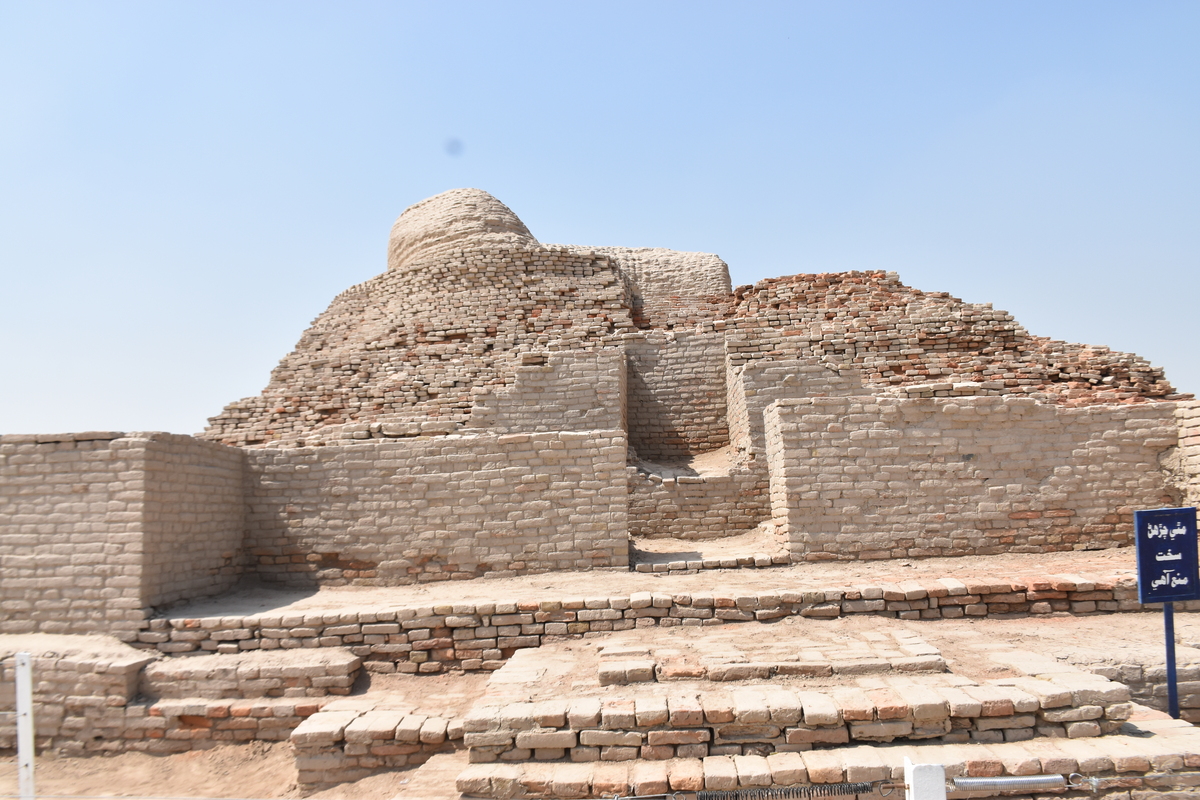
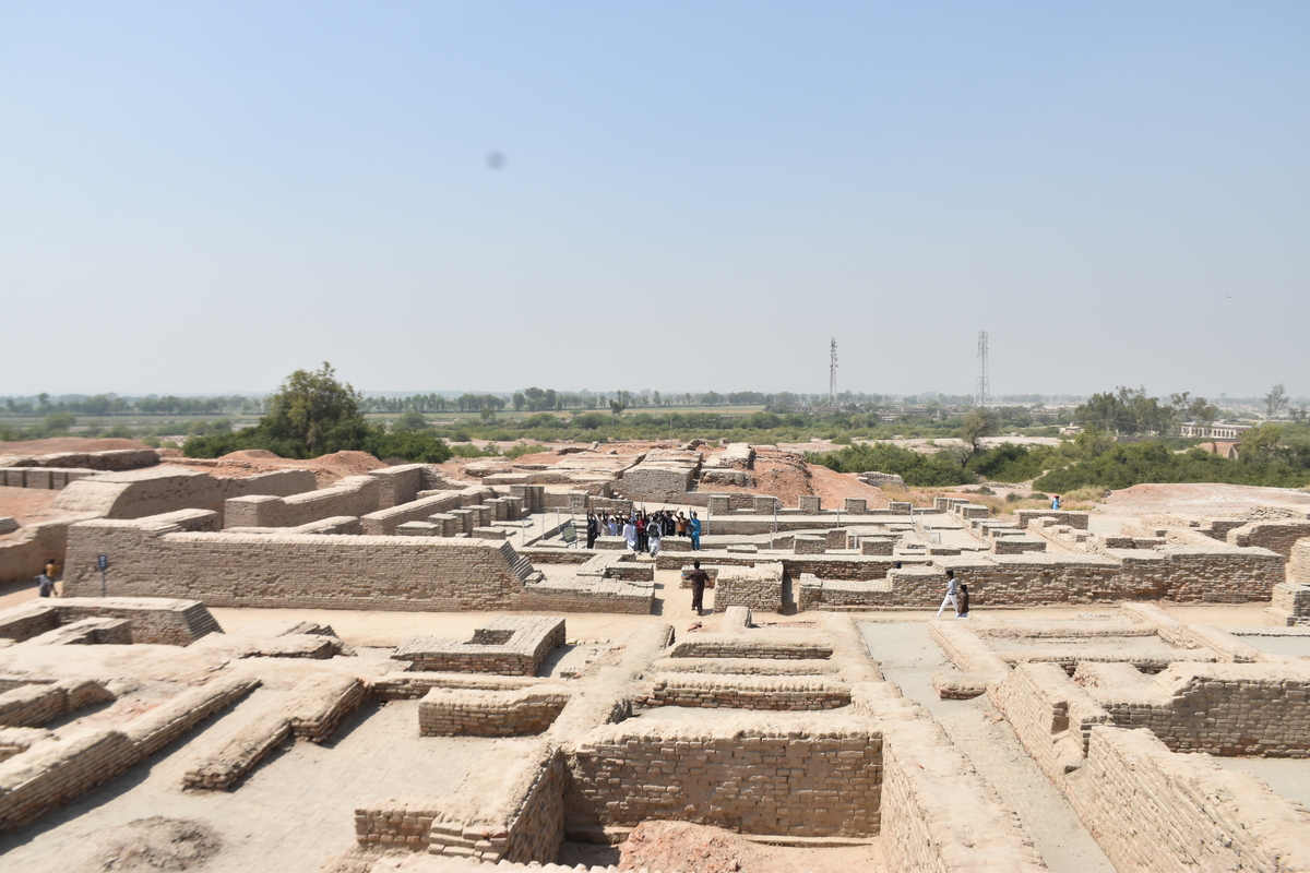
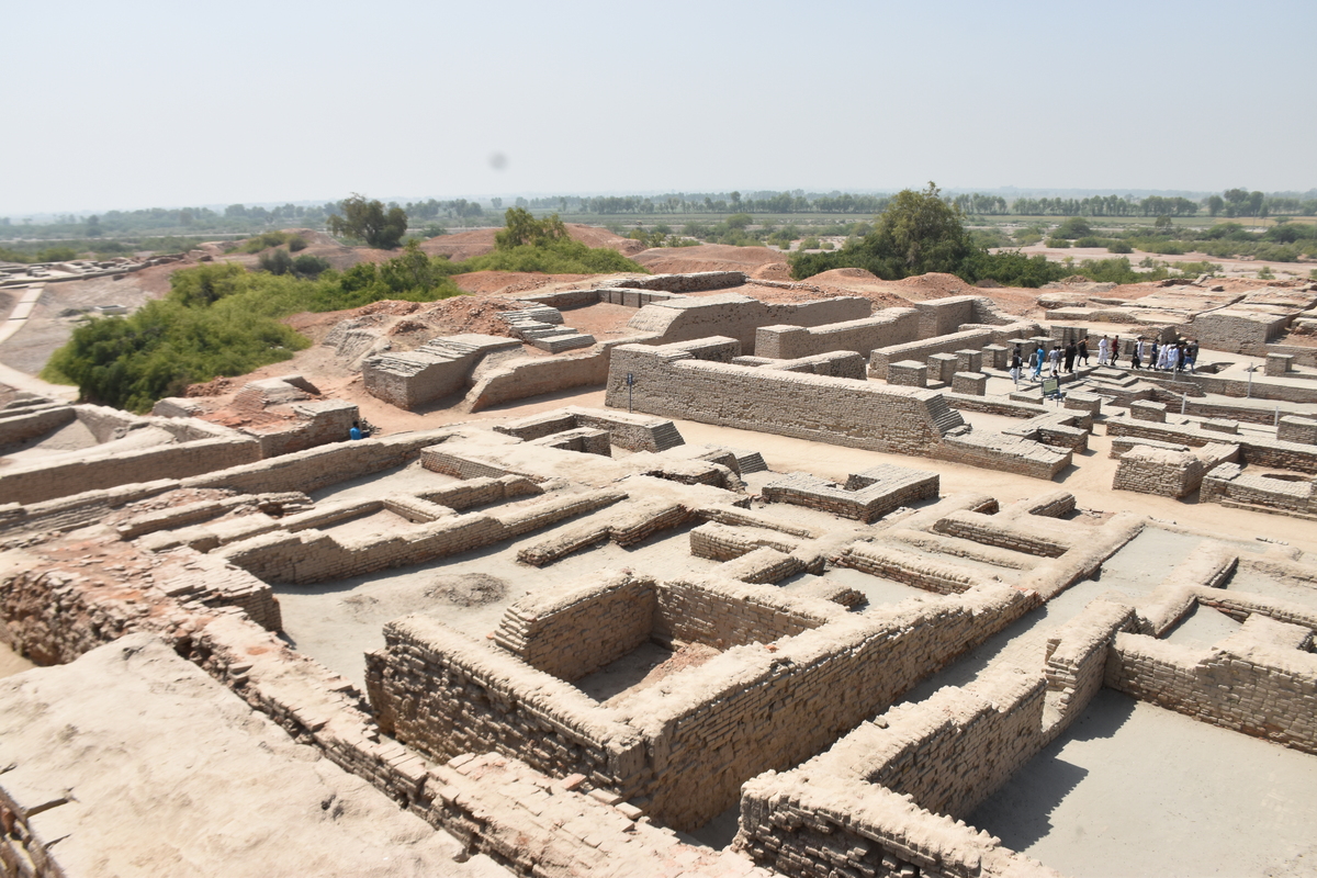
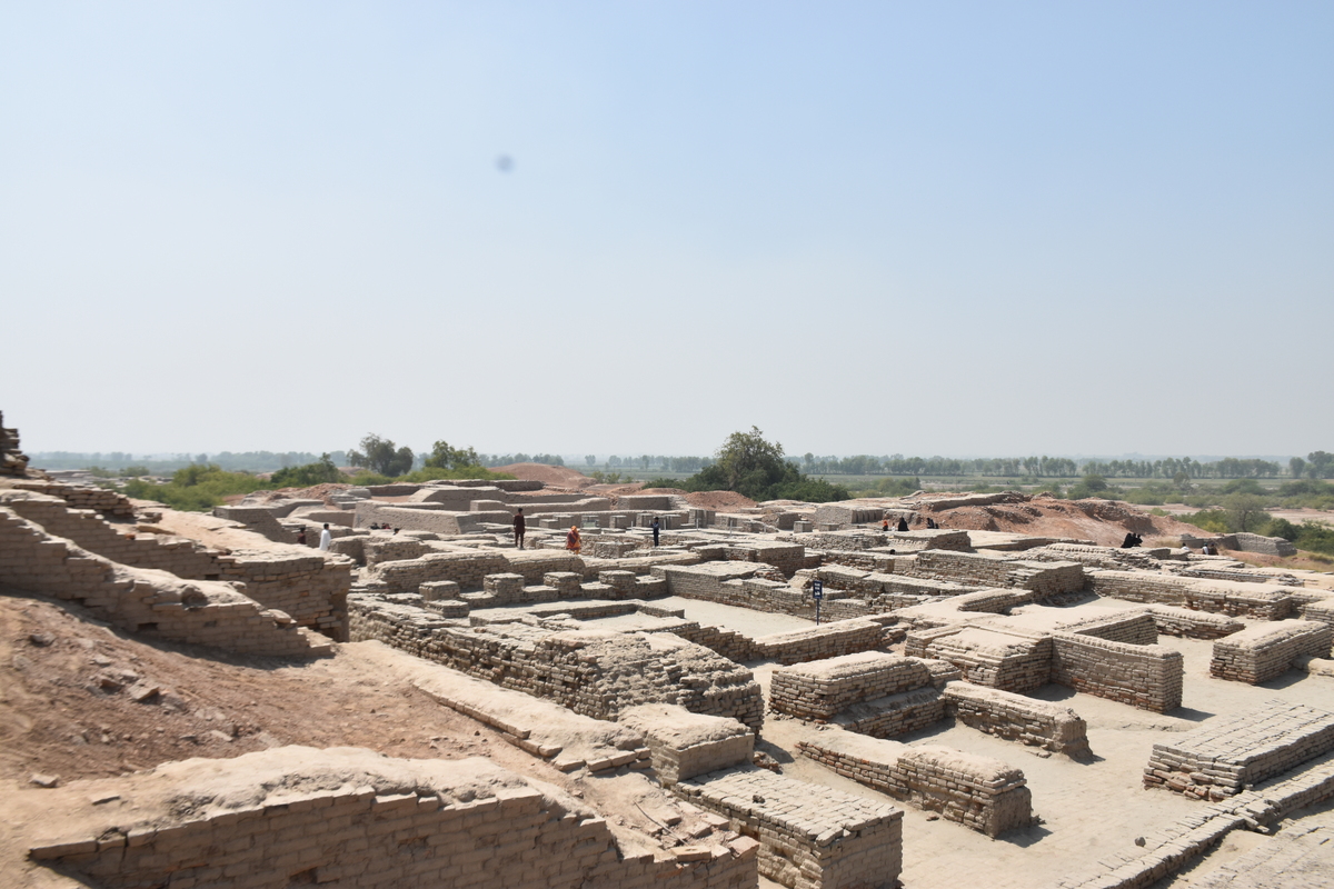
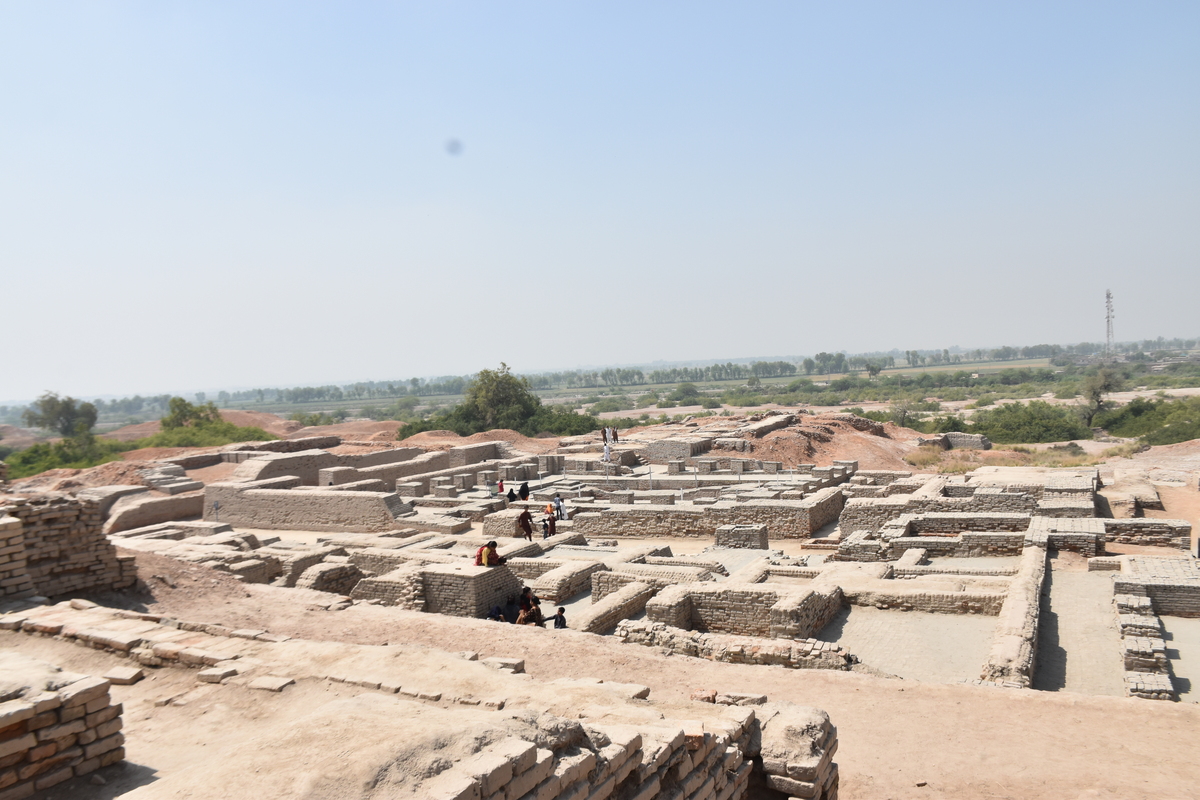
Photographs: Department of Archaeology & Museums national inventory record, displayed from the official source (doam.gov.pk). Not PWHI photography.
- Record ID
- 4870
- Province / territory
- Sindh
- District
- Larkana
- Typology
- Archaeological Site
- Subtype
- Settlement
- Period
- Proto Historic
- Legal status
- Protected by The Antiquity Act 1975 (As amended in 1992) (instrument: Protected by The Antiquity Act 1975 (As amended in 1992))
- World Heritage
- Archaeological Ruins at Moenjodaro
- Coordinates
- 27.32766, 68.13224 — source-provided, not field-verified
- Verification status
- source_record; automatically_standardized; verification_required
- Sources
- Jansen, Michael, Yasmeen Lari. (2015). Inventory of Cultural Property in the Province of Sindh, Pakistan, 2015. Government of Sindh, Vol 3.
Found an error in this record? Submit a correction — quote record ID 4870.
Pakistan's Heritage Digital Ecosystem: Heritage Atlas · PWHI · Visual Record · Forum