
Heritage record
Kalan Kot Remains at Makli Hills
SindhFortWorld Heritage propertyProtected
It is located in 7 km north-west of Thatta city and about 7 km south of Makli necropolis on Kalan Kot Fort Road on the larger Makli Hills extension. Kalan Kot Fort also known by its old name Tughluqabad was built probably in 14th century along with Thatta, as the capital of the Jams of the Samma Dynasty, and, according to the Tuhfatul Kirám, it was founded by Jám Pániya, under the Makli Hill, about 7 km north-west of Thatta. Kalan Kot means the great fort. Common people and even scholars are unaware of Kalan Kot Fort that stands tall and mysterious in its tragic ruins among the dry landscape. No one is quite sure about the origins of the fort and who laid its first foundations, oral traditions and local histories point to some possible theories. Kalan Kot (the Great Fort) is known by many other names like Samma Fort, Taghzul Abad or Kalyana Kot (the word ‘Kalyan’ means peace and prosperity in Sanskrit). The Fort had also been the stronghold for several ruling dynasties. The Mughals also left their mark on the fort, and it remained in use till the time of Aurangzeb. It was renamed to Tugril Abad, after a Mughal officer named Tughril Baig who used Kalan Fort as an ammunition depot to store weapons. Another historical account takes the side of local ruler Mirza Jani Baig, who may have begun restoration in the last quarter of the 16th century, but fled when Akbar’s troops entered Sindh.
The fort is extensive and appears to be an irregular oblong in plan. The fort walls together with circular bastions are built with a core of mud bricks lined on either side with a layer of burnt bricks laid in mud mortar. The thickness of this burnt brick lining is about 10 inches. From the structure remains which are still available on the site, it is quite evident that the entire area of the fort was divided into different sectors each beset with various type of residential buildings. Nothing is left of such a big fort except some dilapidated portion of the fortification wall or ruined bastions. The only conspicuous feature among the remains is the ruined mosque with a big tank in front of it. The rough extent of the mosque may be taken as 75 m x 50 m and that of the tank 30 m x 26 m with a depth of 4 ½ m. What remains now of the mosque is the main roofless prayer chamber with its main entrance arch on east thickness of which is 3 m. The existing height of the walls is about 7 ½ m. In the mehrab on west there are remain of honey-combed plaster work. The jambs and spandrels of the upper niches are lined with white/blue glazed tiles the traces of which can still be seen. The floor of the mosque was paved with plain tiles. The main entrance arch of the mosque has been lined with cut and dressed brick tiles laid in mud mortar but the visible joints deeply treated with lime chiroli mortar. A damaged stone pulpit beautifully carved in floral design also occupies the space in NW corner of the mosque. The tank lying in front of the mosque is deeply cut out in rock lined with bricks laid in lime mortar and finally and finally covered with thick lime plaster. The lake near the fort served as a moat and was built to protect the fort and its residents from invaders. Historically, water from River Indus used to flow into the lake.
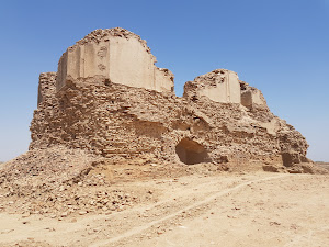
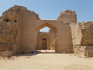
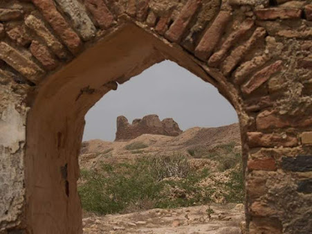
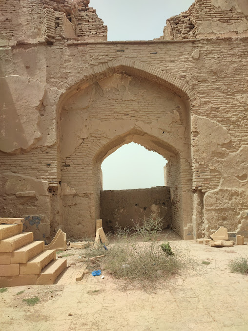
Photographs: Department of Archaeology & Museums national inventory record, displayed from the official source (doam.gov.pk). Not PWHI photography.
- Record ID
- 5528
- Province / territory
- Sindh
- District
- Thatta
- Typology
- Monument
- Subtype
- Fort
- Period
- Historic
- Legal status
- Not Protected — UNVERIFIED; no statute or notification cited
- World Heritage
- Historical Monuments at Makli, Thatta
- Coordinates
- 24.70499, 67.87845 — source-provided, not field-verified
- Verification status
- source_record; automatically_standardized; verification_required
- Sources
- Jansen, Michael, Yasmeen Lari. (2015). Inventory of Cultural Property in the Province of Sindh, Pakistan, 2015. Government of Sindh, Vol 4.
Found an error in this record? Submit a correction — quote record ID 5528.
Pakistan's Heritage Digital Ecosystem: Heritage Atlas · PWHI · Visual Record · Forum